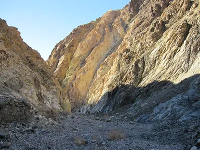
Military Canyon & Mill BM – Death Valley National Park

An unofficially-named canyon in the Owlshead Mountains south of Drone Canyon and South Drone Canyon. By following the canyon upward, you can reach Mill Benchmark with fantastic views of the surrounding area. Total Distance: 16.2 miles out & back Elevation Gain: 3,026ft. (149ft. to 3,125ft.) Difficulty: Very Extremely Strenuous 10+ Mile Difficulty: Extremely Strenuous View […]

South Quartz Canyon – Death Valley National Park

An unofficially-named canyon in the Owlshead Mountains south of Quartz Canyon. Total Distance: 13.6 miles out & back Elevation Gain: 2,404ft. (1,49ft. to 2,491ft.) Difficulty: Exremely Strenuous 10+ Mile Difficulty: Very Strenuous View Rating: Author’s Rating: Visitor Rating: Visitor Difficulty Rating: Pets: No Horses: Yes Best Seasons: November-April Special Permits: None Water Availability: No potable […]

South Smoke Tree Canyon – Death Valley National Park

An unofficially-named canyon in the Owlshead Mountains filled with smoke trees. Total Distance: 14.0 miles out & back Elevation Gain: 2,480ft. (-2ft. to 2,378ft.) Difficulty: Extremely Strenuous 10+ Mile Difficulty: Very Strenuous View Rating: Author’s Rating: Visitor Rating: Visitor Difficulty Rating: Pets: No Horses: Yes Best Seasons: November-April Special Permits: None Water Availability: No potable […]

Through Canyon – Death Valley National Park

Hike all the way through (thus the canyon’s name) the Owlshead Mountains via a desert canyon. Through Canyon is the southernmost of the five officially-named canyons in the northeastern section of the Owlsheads. Total Distance: 17.2 miles out & back Elevation Gain: 2,108ft. (-22ft. to 1,967ft.) Difficulty: Extremely Strenuous 10+ Mile Difficulty: Very Strenuous View […]

Con Benchmark – Death Valley National Park

Trek to a small mountaintop with a US Coast & Geodetic Survey triangulation station marker and great views of Owl Lake, Death Valley, and nearby canyons. Total Distance: 12.5 miles out & back Elevation Gain: 3,104ft. (-70ft. to 2,642ft.) Difficulty: Extremely Strenuous 10+ Mile Difficulty: Very Strenuous View Rating: Author’s Rating: Visitor Rating: Visitor Difficulty […]

Contact Canyon – Death Valley National Park

The most scenic of the five officially-named canyons in the northeastern section of the Owlshead Mountains with rock formations along the wide wash. Contact Canyon is the middle of the five, with Owlshead Canyon to the north and Granite Canyon to the south. Total Distance: 15.0 miles out & back Elevation Gain: 2,638ft. (-71ft. to […]

Owlshead Canyon – Death Valley National Park

Explore a desert canyon with rock formations, narrows, and scalable dryfalls. Owlshead Canyon is the second-northernmost officially-named canyon on the east side of the Owlshead Mountains. Total Distance: 12.0 miles out & back Elevation Gain: 2,708ft. (-97ft. to 2,210ft.) Difficulty: Extremely Strenuous 10+ Mile Difficulty: Very Strenuous View Rating: Author’s Rating: Visitor Rating: Visitor Difficulty […]

Brown Peak (East Approach) – Death Valley National Park

Scramble up an unassuming but very pretty peak to fantastic views of the surrounding area. Total Distance: 10.4 miles out & back Elevation Gain: 3,139ft. (1,833ft. to 4,949ft.) Difficulty: Extremely Strenuous 10+ Mile Difficulty: Very Strenuous View Rating: Author’s Rating: Visitor Rating: Visitor Difficulty Rating: Pets: No Horses: Yes Best Seasons: November-April Special Permits: None […]

Pyramid Peak – Death Valley National Park

Climb up a beautiful peak on the southern edge of the Funeral Mountains to great views of the Funeral Mountains, Black Mountains, Death Valley, Panamint Mountains, and beyond. Total Distance: 9.2 miles out & back Elevation Gain: 3,768ft. (3,055ft. to 6,696ft.) Difficulty: Extremely Strenuous 5-10 Mile Difficulty: Extremely Strenuous View Rating: Author’s Rating: Visitor Rating: […]