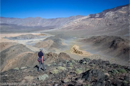
4×4 Road: Hanaupah Canyon Road – Death Valley National Park

High clearance-required 4×4 road to a desert oasis/spring. The first 5 miles are accessible to high clearance, 2WD vehicles. Telescope Peak rises above the top of the canyon, creating the largest vertical drop in the park. Total Distance: 8.2 miles point-to-point (dead end) Elevation Gain: 3,533ft. (-241ft. to 3,212ft.) Road Difficulty: 2.0+ for the first […]

Shorty’s Well – Death Valley National Park

Very short walk to a well discovered by “Shorty” Alexander Zachariah Borden, an early prospector to Death Valley. This is not the same “Shorty” (Frank Harris) who is buried a few miles south along the West Side Road. Total Distance: 0.01 miles out & back Elevation Gain: N/A Difficulty: Easy 0-5 Mile Difficulty: Easy View […]

Tule Spring to Badwater Flats – Death Valley National Park

Short walk on an old road to the western side of Badwater Flats. Total Distance: 1.0 miles out & back Elevation Gain: 33ft. (-270ft. to -281ft.) Difficulty: Easy 0-5 Mile Difficulty: Easy View Rating: Author’s Rating: Visitor Rating: Visitor Difficulty Rating: Pets: No Horses: No Best Seasons: October-May Special Permits: None Water Availability: None Overnight […]

Gold Valley Road – Death Valley National Park

Follow a 4×4 track off of the Greenwater Valley Road through the Black Mountains to Willow Spring and Gold Valley. Total Distance: 13.0 miles point-to-point (dead end) Elevation Gain: 1,432ft. up, 1,877ft. down (4,479ft. to 2,637ft.) Road Difficulty: 2.0 (4×4 required) Bicycle Difficulty: More Difficult View Rating: Author’s Rating: Visitor Rating: Visitor Difficulty Rating: Pets: […]

Greenwater Townsite Road (South) – Death Valley National Park

This is the southerly of the two roads leaving the Greenwater Valley Road to approach Greenwater Townsite. From Greenwater, it continues northwest to meet the Furnace Townsite Road. Total Distance: 5.6 miles point-to-point Elevation Gain: 1,077ft. up, 192ft. down (3,880ft. to 4,765ft.) Road Difficulty: 1.8 (high clearance required) Bicycle Difficulty: More Difficult View Rating: Author’s […]

Furnace Townsite Road – Death Valley National Park

Take a high clearance dirt road off of the Greenwater Valley Road to the quiet site of a tent city. Total Distance: 4.0 miles point-to-point (dead end) Elevation Gain: 1,582ft. up, 4ft. down (3,480ft. to 5,057ft.) Road Difficulty: 1.8 (high clearance required) Bicycle Difficulty: Very Difficult View Rating: Author’s Rating: Visitor Rating: Visitor Difficulty Rating: […]

Undertaker Canyon – Death Valley National Park

Scramble up a remote slot canyon in the Funeral Mountains off of Hole in the Wall Road to Widowmaker Dryfall. Serious scrambling is required – you may want ropes for this one. Total Distance: 5.0 miles out & back Elevation Gain: 1,917ft. (1,891ft. to 3,597ft.) Difficulty: Strenuous 0-5 Mile Difficulty: Very Strenuous View Rating: Author’s […]

Slit Canyon – Death Valley National Park

Hike to and up a remote slot canyon in the Funeral Mountains off of Hole in the Wall Road. Some scrambling is required. Total Distance: 9.4 miles out & back Elevation Gain: 3,029ft. (1,891ft. to 4,187ft.) Difficulty: Very Strenuous 5-10 Mile Difficulty: Extremely Strenuous View Rating: Author’s Rating: Visitor Rating: Visitor Difficulty Rating: Pets: No […]

Echo Canyon Overlook – Death Valley National Park

Take Echo Canyon – the longest canyon in the Funeral Mountains – to an overlook of the Amargosa Desert. Total Distance: 6.8 miles out & back Elevation Gain: 698ft. (4,123ft. to 4,731ft.) Difficulty: Moderate 5+ Mile Difficulty: Moderately Strenuous View Rating: Author’s Rating: Visitor Rating: Visitor Difficulty Rating: Pets: No Horses: Yes Best Seasons: November-April […]