Head Benchmark – Death Valley National Park

Cross-country hike to the second-highest named summit in the Quail Mountains. Total Distance: 7.4 miles out & back Elevation Gain: 1,379ft. (2,11ft. to 3,486ft.) Difficulty: 5-10 Mile Difficulty: View Rating: Author’s Rating: Visitor Rating: Visitor Difficulty Rating: Pets: No Horses: Yes Best Seasons: November-April Special Permits: None (do not go south into the Fort Irwin […]

Jubilee Pass Road – Death Valley National Park

The main entrance to the southern part of Death Valley National Park, connecting CA-127 to the south end of the Badwater Road/north end of the Harry Wade Road. Total Distance: 25.0 miles point to point Elevation Gain: 2,016ft. up, 3,632ft. down east to west (3,292ft. to 25ft.) Road Difficulty: 0.6 Bicycle Difficulty: Easy View Rating: […]

Military Canyon & Mill BM – Death Valley National Park

An unofficially-named canyon in the Owlshead Mountains south of Drone Canyon and South Drone Canyon. By following the canyon upward, you can reach Mill Benchmark with fantastic views of the surrounding area. Total Distance: 16.2 miles out & back Elevation Gain: 3,026ft. (149ft. to 3,125ft.) Difficulty: 10+ Mile Difficulty: View Rating: Author’s Rating: Visitor Rating: […]

Con Benchmark – Death Valley National Park

Trek to a small mountaintop with a US Coast & Geodetic Survey triangulation station marker and great views of Owl Lake, Death Valley, and nearby canyons. Total Distance: 12.5 miles out & back Elevation Gain: 3,104ft. (-70ft. to 2,642ft.) Difficulty: 10+ Mile Difficulty: View Rating: Author’s Rating: Visitor Rating: Visitor Difficulty Rating: Pets: No Horses: […]

Manly Peak & Anvil Benchmark – Death Valley National Park
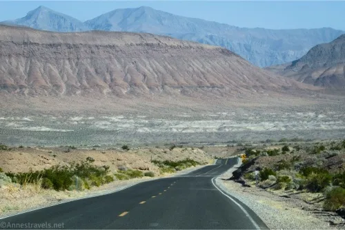
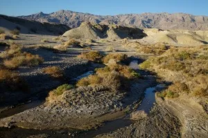
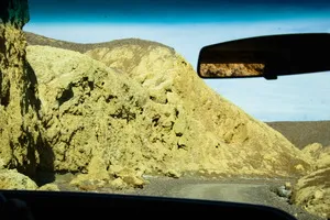
Scramble up a peak with quite a bit of prominence with views over Butte Valley and much more. Total Distance: 5.6 miles out & back Elevation Gain: 3,479ft. (4,390ft. to 7,129ft.) Difficulty: trail_difficulty_overall elevation=’3,479′ distance=’5.6′] 5-10 Mile Difficulty: trail_difficulty_mile elevation=’3,479′ distance=’5.6′] View Rating: Author’s Rating: Visitor Rating: Visitor Difficulty Rating: Pets: No Horses: Yes Best […]

Harmony Borax Works – Death Valley National Park

An ADA-accessible path leads to the ruins of a very successful borax refinery that operated between 1883 and 1888. Total Distance: 0.4 mile lollipop loop Elevation Gain: 71ft. (-250ft. to -216ft.) Difficulty: 0-5 Mile Difficulty: View Rating: Author’s Rating: Visitor Rating: Visitor Difficulty Rating: Pets: No Horses: No Best Seasons: October-May Special Permits: None Water […]

Latest Trails

2WD Dirt Road Access 4x4 Access 4x4 Dirt Road Backpacking badlands Badwater Road Bicycles Black Mountains CA-190 CA-190 East California canyon colorful rocks Day Hiking Death Valley National Park Dirt Road Easy Hike Extremely Strenuous Hike Funeral Mountains Geological Interest Ghost Town Grapevine Mountains Harry Wade Road High Clearance Access High Clearance Dirt Road Historic Interest Horses Jeeps Mine Moderate Hike Moderately Strenuous Hike Owlshead Mountains Panamint Mountains Paved Road Access Pets point of interest rock formations Rumored Hike Spring Strenuous Hike Titus Canyon Road Verified Hike Very Strenuous Hike views West Side Road

Categories

Archives