CA-127 & NV-373 – Death Valley National Park
The state highway along the east side of Death Valley National Park, from Baker, CA (I-15) to US-95 north of Amargosa Valley, NV.
| Total Distance: 107.0 miles point to point | Elevation Gain: 3,668ft. up, 1,939ft. down (406ft. to 2,663ft.) |
| Road Difficulty: 0.6 | Bicycle Difficulty: Easiest |
| View Rating: 3.0 out of 5.0 stars | Rating: 2.0 out of 5.0 stars |
| Visitor Rating: (Click to rate) [Total: 0 Average: 0] | Visitor Difficulty Rating: (Click to rate) [Total: 0 Average: 0] |
| Pets: Leashed | Horses: No |
| Best Seasons: October-May | Special Permits: None |
| Water Availability: Water is available in Shoshone and Death Valley Junction | Overnight Options: RV parks and lodging are available in Shoshone and just over the border into Nevada |
| Amenities: Fuel and lodging available in Shoshone; lodging available in Death Valley Junction, Amargosa Valley, and occasionally along the way | Crowd Factor: Moderate |
| Uses: | Road surface: |
| Features: | Hazards: |
Mile-by-Mile: CA-127 & NV-373
0.0 CA-127/I-15 Junction in Baker, CA (936ft.). Drive north. The road passes through the desert and between rough hills. (35.263264°, -116.073067°)
29.9 Saratoga Spring Road on left (west) (471ft.). Continue north (straight) on the main road. (35.632837°, -116.290619°)
39.9 Ibex Spring Road on left (west) (1,605ft.). Continue north (straight) on the main road. (35.772217°, -116.325506°)
41.6 Ibex Pass (2,088ft.). Continue on CA-127N. (35.793657°, -116.339960°)
48.1 Old Spanish Trail on right (southeast) (1,394ft.). Continue straight on CA-127N. (35.871334°, -116.286882°)
51.1 Tecopa Hot Springs Road on right (east) (1,381ft.). Continue straight. (35.899623°, -116.258703°)
51.2 Furnace Creek Wash Road on left (west) (1,383ft.). Continue straight on the main road. (35.901366°, -116.259470°)
56.3 CA-178 goes off on right (east) (1,575ft.). This is the “town” of Shoshone. (35.972666°, -116.270344°)
58.0 Jubilee Pass Road (CA-178) on left (west) (1,642ft.). Continue north on CA-127. (35.996319°, -116.274909°)
75.7 Deadman Pass Road on left (2,065ft.). This unmarked, rough 4×4 road can be used to access the Greenwater Valley Road. (36.2099490°, -116.3894020°)
83.4 State Line Road on right (east) (2,043ft.). This is Death Valley Junction. (36.302109°, -116.414362°)
83.5 CA-190 Junction on left (2,045ft.). You would turn left here to access Furnace Creek and much of Death Valley National Park. To continue on CA-127, drive straight. (36.304619°, -116.415234°)
90.7 Nevada State Line (2,155ft.). The road changes name to NV-373. (36.408306°, -116.422326°)
96.7 Amargosa Valley (2,278ft.). Continue north on NV-373. (36.494921°, -116.421352°)
107.0 US-95 (2,663ft.). NV-373 effectively ends here. (36.643736°, -116.400310°)
History & More
The Amargosa Valley – through which CA-127/NV-373 travels – has at least 24 different plants and animals that are found nowhere else in the world.
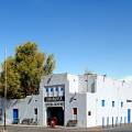
The Amargosa Opera House (in Death Valley Junction) was built as part of a “company town” by the Pacific Coast Borax Company in 1923-1925 as a recreation hall. In 1942, the railroad decided service to the town was unprofitable; the tracks were torn up and sent to Egypt to help with the Allied war effort. The buildings changed hands several times until Marta Becket rented the recreation hall in 1967 and turned it into an opera house, complete with Southwest-style murals. She staged dance and mime shows on the stage until 2012; performances are still sometimes available.
Download Road Map
Coming soon!
Trailhead Location
Southern terminus: Baker, California, along I-15.
Eastern terminus: The “town” of Amargosa Valley along US-95.
Leave No Trace Principles are enforced
Drones and model aircrafts are prohibited
Camping is permitted only in designated sites or in areas open to dispersed backcountry camping
Click here for all park rules and regulations
12 Month Pass: $55/Death Valley Annual Pass (valid at Death Valley National Park). $80/America the Beautiful Annual Pass (valid at all national park and federal fee areas). $20/Annual Senior Pass (62 years or older US citizens; valid at all national park and federal fee areas). Free/4th Grade Pass (Valid Sept. 1-August 31 of the child’s 4th Grade school year). Free/Military Pass (valid for all active military personel and their dependents with a CAC Card or DD Form 1173).
Lifetime Pass: $80/Lifetime Senior Pass (62 years or older US citizens; valid at all national park and federal fee areas). Free/Access Pass (available to all US citizens with perminent disabilities). Free/Access for Veterans and Gold Star Families Pass (valid for all military and veterans with a CAC card, Veteran HJealth Identification Card, Veteran ID Card, or veteran’s designation on state-issued drivers license or identification card.)


