CA-190: Death Valley Junction to Furnace Creek – Death Valley National Park


Photo credit Joy Whiting, All Rights Reserved
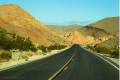
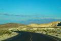
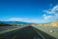
The main access road for Death Valley from the east (including from Las Vegas), this section of CA-190 stretches between CA-127 (at Death Valley Junction) and Furnace Creek. It passes features like 20 Mule Team Scenic Drive, Zabriskie Point, and Dantes View before passing the Badwater Road and entering the settlement of Furnace Creek near the main Death Valley National Park Visitor Center.
| Total Distance: 30.2 miles point to point | Elevation Gain: 1,030ft. up, 3,257ft. down (3,056ft. to -183ft.) |
| Road Difficulty: 0.6 | Bicycle Difficulty: Easiest |
| View Rating: 4.0 out of 5.0 stars | Rating: 4.0 out of 5.0 stars |
| Visitor Rating: (Click to rate) [Total: 0 Average: 0] | Visitor Difficulty Rating: (Click to rate) [Total: 0 Average: 0] |
| Pets: Leashed | Horses: No |
| Best Seasons: October-May | Special Permits: None |
| Water Availability: Water is available 24/7 at the Furnace Creek Visitor Center | Overnight Options: Lodging is available in Death Valley Junction and in/near Furnace Creek. Camping is available in/near Furnace Creek. |
| Amenities: Occasional primitive toilets at trailheads; water and services in Furnace Creek | Crowd Factor: Crowded |
| Uses: | Road surface: |
| Features: | Hazards: |
Mile-by-Mile: CA-190 Death Valley Junction to Furnace Creek
0.0 Death Valley Junction (2,045ft.). At the junction of CA-127 and CA-190, turn onto CA-190 to travel west. (36.304619°, -116.415234°)
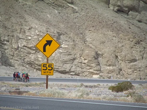
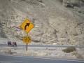
16.4 Enter Death Valley National Park (2,358ft.). A sign with a pulloff marks the boundary. The road winds downhill along the wash. Enjoy views of the nearby hills. (36.375334°, -116.684410°)
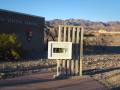
17.8 Death Valley Entrance Station on Right (west) (2,085ft.). Restrooms and a sign kiosk welcome visitors to the park. You can also pay your entrance fee here. (36.366012°, -116.703968°)
18.2 Dantes View Road on left (south) (2,002ft.). Continue straight when the Dantes View Road strikes left (south). (36.363071°, -116.709177°)
19.4 Nevares Springs Road on right (north) (1,771ft.). Continue west. (36.368986°, -116.729390°)
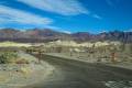
22.6 Exit to 20 Mule Team on left (south) (1,164ft.). Do not enter as the road is one-way. (36.397922°, -116.770275°)
23.5 Hole in the Wall Road on right (north) (992ft.) (2,045ft.). Continue west on the paved road. (36.404832°, -116.782823°)
24.2 20 Mule Team Scenic Drive Entrance on left (south) (860ft.). The scenic drive is one-way traffic from west to east. Continue straight on the main road. (36.409644°, -116.794734°)
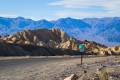
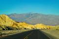
25.4 Zabriskie Point Parking Area on left (west) (665ft.). Parking area is the trailhead for Zabriskie Point and the Badlands Loop. (36.421047°, -116.808891°)
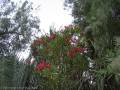
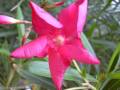
26.8 Echo Canyon Road on right (north) (409ft.). Continue downhill on the paved road. The scenery becomes more lush; Furnace Creek flows through here and is visible most of the year along the side of the road. The badlands along the road and creek are very beautiful. (36.437606°, -116.824091°)
28.8 The Inn at Death Valley (30ft.). Continue downhill on the main road. (36.449944°, -116.851262°)
28.9 Badwater Junction / Badwater Road on left (south) (3ft). Drive straight toward Furnace Creek. (36.4483869°, -116.8527152°)
29.6 Indian Village Road/Texas Springs Road Junction (-138ft.). Indian Village Road strikes left (south) while the Texas Springs Road up to the Sunset Campground and Texas Springs Campground turns right (north). Continue straight into the “town” of Furnace Creek. (36.453018°, -116.863723°)
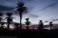
29.9 The Ranch at Death Valley Entrance on left (west) (-169ft.). Continue straight. Directly after this is a gravel parking area that serves the picnic area in the shade of the palms. This is followed by the Furnace Creek Gas Station and Farabee’s Jeep Rentals. (36.457141°, -116.865185°)
30.2 Airport Road on Left (West) (-183ft.). Turn left to access the Furnace Creek Visitor Center. To continue on CA-190, see this guide. (36.460838°, -116.865494°)
History & More
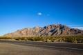
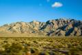
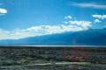
This part of CA-190 passes by three mountain ranges: the Funeral Mountains to the north and the Green Mountains and Black Mountains to the south.
The Amargosa Opera House in Death Valley Junction was built by the Pacific Coast Borax Company in 1923 and included a dormitory, a 23-room hotel with a dining room, a store, company offices, and a recreation hall. At the time, the town was a the terminus of the Tonopah and Tidewater Railroad and as such was a major center of activity in the area. When the railroad was closed in 1942, the tracks were torn up and sent to Egypt, where they were relaid to help with the Allies’ military efforts. Marta Becket rented the recreation hall in 1967 and turned it into a world-famous opera house with performances of dance and mime.
Furnace Creek holds the record for the hottest recorded air temperature on earth – 134°F (56.7°C) on July 10, 1913. It also holds the record for the highest recorded natural ground surface temperature on Earth – 201°F (93.9°C) on July 15, 1972.
The Timbisha Shoshone Tribe lives in Furnace Creek. Houses were constructed for the tribe by the CCC in 1938. You can visit the village today if the sign indicates that it’s open. I hear the Indian Tacos are amazing.
Furnace Creek has had a long history of being the center of operations in Death Valley. In 1883, the William Tell Coleman Borax Company created the Greenland Ranch – the alfalfa that the company planted near the creek gave the ranch its name. The ranch was renamed the Furnace Creek Ranch in 1933. Between these times, the Pacific Coast Borax Company and the historic 20 Mule Team were both centered near the ranch.
Download Road Map
Trailhead Location
Eastern terminus: Death Valley Junction on CA-127 27 miles north of Shoshone, 24 miles south of Lathrop Wells on US-95, and 31 miles east of Pahrump via Bell Vista Avenue/State Line Road.
Western terminus: Furnace Creek Visitor Center, 24.2 miles east of Stovepipe Wells.
Driving Directions
From Las Vegas, drive north on US-95N for about 87 miles. Turn left onto NV-373S for 16.3 miles; enter California and continue straight another 7.2 miles (the road is now called CA-127S). You are now in Death Valley Junction; turn right for a very short distance and then left onto CA-190.
From the south, take I-15 Exit 246 toward CA-127 and Kelbaker Road toward Death Valley. Turn north at the end of the exit ramp onto CA-127N and drive 83.6 miles. You are now in Death Valley Junction; turn left onto CA-190.
Leave No Trace Principles are enforced
Drones and model aircrafts are prohibited
Camping is permitted only in designated sites or in areas open to dispersed backcountry camping
Click here for all park rules and regulations
12 Month Pass: $55/Death Valley Annual Pass (valid at Death Valley National Park). $80/America the Beautiful Annual Pass (valid at all national park and federal fee areas). $20/Annual Senior Pass (62 years or older US citizens; valid at all national park and federal fee areas). Free/4th Grade Pass (Valid Sept. 1-August 31 of the child’s 4th Grade school year). Free/Military Pass (valid for all active military personel and their dependents with a CAC Card or DD Form 1173).
Lifetime Pass: $80/Lifetime Senior Pass (62 years or older US citizens; valid at all national park and federal fee areas). Free/Access Pass (available to all US citizens with perminent disabilities). Free/Access for Veterans and Gold Star Families Pass (valid for all military and veterans with a CAC card, Veteran HJealth Identification Card, Veteran ID Card, or veteran’s designation on state-issued drivers license or identification card.)
19 thoughts on “CA-190: Death Valley Junction to Furnace Creek – Death Valley National Park”