Badwater Basin – Death Valley National Park

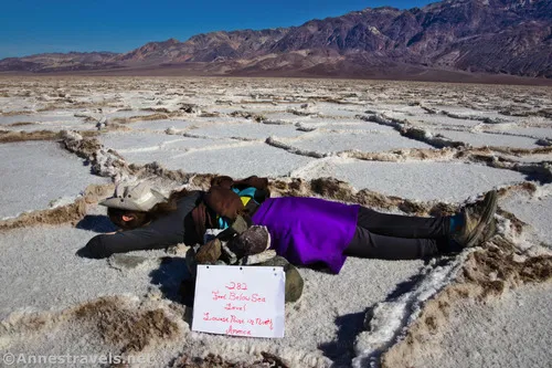
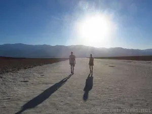
Stand in the lowest place in North America and explore the edge of a salt flat. Total Distance: 0.25+ miles out & back with spurs Elevation Gain: 27ft. (-270ft. to -280ft.) Difficulty: Easy 0-5 Mile Difficulty: Easy View Rating: Author’s Rating: Visitor Rating: Visitor Difficulty Rating: Pets: In the parking lot only (no dogs on […]

Lowest Point in North America – Death Valley National Park

Discover the lowest point in North America, deep in the salt flats of Badwater Basin. Total Distance: 7.0 miles out & back Elevation Gain: 212ft. (-270ft. to -282ft.) Difficulty: Moderate 5+ Mile Difficulty: Moderate View Rating: Author’s Rating: Visitor Rating: Visitor Difficulty Rating: Pets: No Horses: No Best Seasons: November-April; impassable when wet Special Permits: […]

Badwater Road – Death Valley National Park

T he main access road for Badwater Basin as well as for other famous hikes, including Golden Canyon and Devils Golf Course, as well as access to the West Side Road. It runs between CA-190 south of Furnace Creek and the Jubilee Pass Road/north end of Harry Wade Road junction. Total Distance: 45.6 miles point […]