Badwater Road – Death Valley National Park


T he main access road for Badwater Basin as well as for other famous hikes, including Golden Canyon and Devils Golf Course, as well as access to the West Side Road. It runs between CA-190 south of Furnace Creek and the Jubilee Pass Road/north end of Harry Wade Road junction.
| Total Distance: 45.6 miles point to point | Elevation Gain: 1,840ft. gain, 1,818ft. loss (-281ft. to 25ft.) |
| Road Difficulty: 0.6 | Bicycle Difficulty: Easiest |
| View Rating: 5.0 out of 5.0 stars | Rating: 4.0 out of 5.0 stars |
| Visitor Rating: (Click to rate) [Total: 0 Average: 0] | Visitor Difficulty Rating: (Click to rate) [Total: 0 Average: 0] |
| Pets: Yes | Horses: No |
| Best Seasons: October-May | Special Permits: None |
| Water Availability: None | Overnight Options: None |
| Amenities: Primitive restrooms at Golden Canyon, the Natural Bridge, and Badwater Basin | Crowd Factor: Moderate |
| Uses: | Road Surface: |
| Features: | Hazards: |
Mile-by-Mile: Badwater Road
0.0 Badwater Junction (3ft). Drive south toward Badwater. (36.4483869°, -116.8527152°)
2.0 Golden Canyon Trailhead Road (-167ft.). Parking area is on left. (36.4204985°, -116.8476835°)
3.7 Desolation Canyon Road (-203ft.). Access road is on left. (36.3966275°, -116.8474730°)
4.8 End of Artist Drive (-203ft.). Artist Drive is on left; do not enter the one-way road. (36.381706°, -116.851133°)
5.9 North End of West Side Road (-67ft.). West side Road is on right. (36.365833°, -116.844937°)
8.6 Beginning of Artist Drive (-163ft.). Entrance to Artist Drive is on left. (36.329933°, -116.829965°)
11.0 Devils Golf Course Road (-198ft.). Road to Devils Golf Course is on right. (36.298583°, -116.811804°)
13.0 Natural Bridge Road (-243ft.). Road to the Natural Bridge is on left. (36.274066°, -116.792859°)
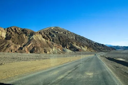
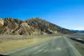
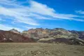
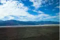
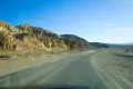
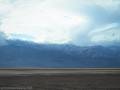
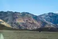
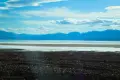
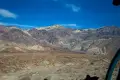
16.5 Badwater Basin Parking Area (-267ft.). Badwater Basin parking area is on right. The road weaves its way along the base of the Black Mountains, with the salt flats on the right (west). (36.230350°, -116.766547°)
31.2 Sidewinder Canyon/Willow Canyon Road (-257ft.). Gravel access road to Sidewinder Canyon is on left. (36.067671°, -116.748005°)
32.75 Mormon Point (-237ft.). Sign on right; point on left. (36.055705°, -116.765323°)
41.9 West Side Road (south end) (-57ft.). West Side Road is on right. (35.937717°, -116.704639°)
43.7 Ashford Mill Road (-74ft.). Gravel access road is on right. (35.920887°, -116.681290°)
45.6 Harry Wade Road (22ft.). The dirt Harry Wade Road goes straight. The main road turns left and becomes Jubilee Pass Road. (35.899862°, -116.656804°)
History & More
The Badwater Road is known for having some of the earliest wildflower displays in the spring, usually beginning in March.
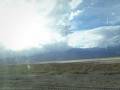
Because the Badwater Road follows the side of Badwater Flats, it’s one of the consistently lowest roads in the park. It rises to a high point of about 25 feet.
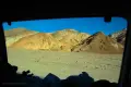
Driving the Badwater Road in the afternoon is a real treat, since the sun shines on the Black Mountains and makes them seem almost to glow. However, views are better across the flats to the Panamint Mountains in the morning. Either way, it’s very scenic and a great place to see sunset.
Badwater Road was also heavily damaged in the same storms that closed Scotty’s Castle for several years. It took the park service 8 months to finish the cleanup and reopen the southern part of the road to the public.
Download Road Map
Driving Directions
Take CA-190 east of Furnace Creek to Badwater Junction, about 1.3 miles south of the visitor center. The junction is also 3.5 miles west of Zabriskie Point on CA-190.
The southern end of the road is the western terminus of the Jubilee Pass Road (CA-178) 25.0 miles west of CA-127 north of Shoshone.
Leave No Trace Principles are enforced
Drones and model aircrafts are prohibited
Camping is permitted only in designated sites or in areas open to dispersed backcountry camping
Click here for all park rules and regulations
12 Month Pass: $55/Death Valley Annual Pass (valid at Death Valley National Park). $80/America the Beautiful Annual Pass (valid at all national park and federal fee areas). $20/Annual Senior Pass (62 years or older US citizens; valid at all national park and federal fee areas). Free/4th Grade Pass (Valid Sept. 1-August 31 of the child’s 4th Grade school year). Free/Military Pass (valid for all active military personel and their dependents with a CAC Card or DD Form 1173).
Lifetime Pass: $80/Lifetime Senior Pass (62 years or older US citizens; valid at all national park and federal fee areas). Free/Access Pass (available to all US citizens with perminent disabilities). Free/Access for Veterans and Gold Star Families Pass (valid for all military and veterans with a CAC card, Veteran HJealth Identification Card, Veteran ID Card, or veteran’s designation on state-issued drivers license or identification card.)
9 thoughts on “Badwater Road – Death Valley National Park”