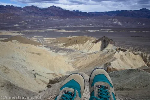
Corkscrew Canyon – Death Valley National Park


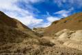
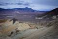
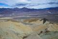
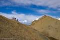
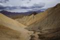
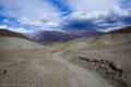


Hike up a wash to badlands and the wash to an old mining area with many old structures and a fun slot canyon.
| Total Distance: 5.0 miles out & back with spur | Elevation Gain: 1,330ft. (1,366ft. to 2,402ft.) |
| Difficulty: Moderately Strenuous | 0-5 Mile Difficulty: Very Strenuous |
| View Rating: 3.0 out of 5.0 stars | Author’s Rating: 4.0 out of 5.0 stars |
| Visitor Rating: (Click to rate) [Total: 0 Average: 0] | Visitor Difficulty Rating: (Click to rate) [Total: 0 Average: 0] |
| Pets: No | Horses: Yes |
| Best Seasons: November-April | Special Permits: None |
| Water Availability: None | Overnight Options: None |
| Trailhead Amenities: None | Crowd Factor: Solitude |
| Trailhead Access: 0.6 | |
Uses:    | Trail Surface:      |
Features:      | Hazards:    |
Mile-by-Mile: Corkscrew Canyon Route
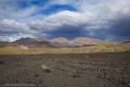
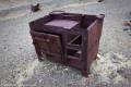
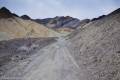
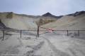
0.0 Old Road along CA-190 (1,368ft.). An old wooden gate is across the road a short distance up it. Pass through the gate and keep following the road uphill. The views are good ahead to the Black Mountains and back toward the Funeral Mountains. About the time the road begins to travel along the Corkscrew Canyon Wash, pass an old stove (marked with “Keep Out!”). The road will pass by some old vehicles as the wash/road narrows, heading into the Black Mountains, up to a metal gate. (36.387322°, -116.755245°)
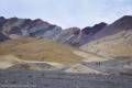
1.3 Modern metal gate (1,652ft.). The road and wash combine at this point. Keep walking as the route twists and turns between yellow hills. (36.3714120°, -116.7633740°)
1.5 Slot Entrance on left (1,756ft.). I opted (unintentionally, but all the same) to do this on the way back down, so I followed the road to the right. At last, the wash rounds a bend and enters the old mine area with its many buildings and a few old mine shafts. (36.3660620°, -116.7630280°)
1.65 Mine area (1,856ft.). Wander around the area, looking at the various buildings and (closed off) mine shafts, then return down the road to hike the slot canyon. The very modern fences make photography difficult, but you can still enjoy the engineering that went into the ore bins, etc. (36.3670530°, -116.7647220°)
1.8 Slot Canyon Entrance (1,756ft.). The slot looks a little boring at first, but it is deep. After a few twists and turns, he wall leans inward to overhang the canyon, almost like you’re in a cave. At least three small dryfalls add excitement without being too difficult to scramble (max an easy Class 3, but more likely Class 2 for many hikers). A natural bridge about mile 2.1 (36.3660620°, -116.7630280°) is one of my favorite parts of the hike. The slot ends in a bowl of badlands and rock formations (mile 2.7; approx. 36.3605810°, -116.7595040°) – explore to your heart’s content before retracing your steps to the trailhead. (36.368371°, -116.763913°)
History & More
Corkscrew Canyon makes a reasonable loop option with 20 Mule Team Canyon – scramble right (west from the more modern metal gate). I’d guess the round-trip distance would be just over 5 miles without trekking up to the old mine area or following Corkscrew Slot.
The road may be difficult to follow in some areas due to washouts. However, I didn’t find it bad, and if you get lost, just keep heading upstream.
At one time, the area beyond the gate was on private property. For many years, no one knew or cared if hikers continued up to the slot canyon and the old mine area. However, in the mid-2010s, the owner suddenly became very concerned about people on the property. Besides installing fences around the old mining equipment, signs appeared, and finally, the area was officially closed to the public. Around 2023, the NPS initiated a land trade to make the mine and surrounding area part of Death Valley National Park.
The area around Corkscrew Canyon was used for mining operations at various times. Buildings still remain in the canyon, but most of them have been fenced off.
If you want another slot canyon adventure, a wash near the mine area (on the left while hiking upcanyon at approx. 36.3664430°, -116.7645380°) goes up a not very narrow nor deep slot canyon to an area (approx. 36.3639400°, -116.7625370°) to look down on the badlands at the top of the official slot – while it’s not very exciting, it is pretty.
Download Trail Map
Driving Directions
Take CA-190 east of Furnace Creek. The unmarked “trailhead” is 3.9 miles east of Zabriskie Point and 3.3 miles west of the Dante’s View Road. The “trailhead” is at the beginning of an old, closed dirt road with a wooden gate across it. Park on the shoulder of the road, do not crush vegetation, and do not obstruct traffic, or park on the gravel of the old road before the gate.
Remember, it may be easier to climb up dryfalls than down them (or vice versa). Be sure you can climb in the other direction before climbing up or down a dryfall.
Leave No Trace Principles are enforced
Drones and model aircrafts are prohibited
Camping is permitted only in designated sites or in areas open to dispersed backcountry camping
All park rules and regulations
12 Month Pass: $55/Death Valley Annual Pass (valid at Death Valley National Park). $80/America the Beautiful Annual Pass (valid at all national park and federal fee areas). $20/Annual Senior Pass (62 years or older US citizens; valid at all national park and federal fee areas). Free/4th Grade Pass (Valid Sept. 1-August 31 of the child’s 4th Grade school year). Free/Military Pass (valid for all active military personel and their dependents with a CAC Card or DD Form 1173).
Lifetime Pass: $80/Lifetime Senior Pass (62 years or older US citizens; valid at all national park and federal fee areas). Free/Access Pass (available to all US citizens with perminent disabilities). Free/Access for Veterans and Gold Star Families Pass (valid for all military and veterans with a CAC card, Veteran HJealth Identification Card, Veteran ID Card, or veteran’s designation on state-issued drivers license or identification card.)
1 thought on “Corkscrew Canyon – Death Valley National Park”