Devils Golf Course – Death Valley National Park


E xplore salt and mud formations on Badwater Flats.
| Total Distance: Varies | Elevation Gain: N/A |
| Difficulty: Easy | 0-5 Mile Difficulty: Easy |
| View Rating: 3.0 out of 5.0 stars | Author’s Rating: 3.0 out of 5.0 stars |
| Visitor Rating: (Click to rate) [Total: 0 Average: 0] | Visitor Difficulty Rating: (Click to rate) [Total: 0 Average: 0] |
| Pets: No | Horses: No |
| Best Seasons: November-April | Special Permits: None |
| Water Availability: None | Overnight Options: None |
| Trailhead Amenities: None | Crowd Factor: Crowded |
| Trailhead Access: 1.1 | |
| Uses: | Trail Surface: |
| Features: | Hazards: |
Mile-by-Mile: Devils Golf Course
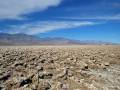
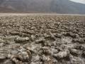
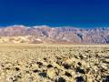
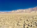
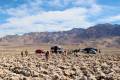
0.0 Devils Golf Course Parking Area (-274ft.). From here, you can read the sign or try to walk among the formations (warning: it’s not easy). There is no official trail. If you go far enough, you may find salt crystal formations; most of the formations near the parking area have been crushed by hikers’ feet. (36.285869, -116.826014)
History & More
The golf course received its name from the 1934 National Park Service Guide to the park. The guide stated that, “Only the devil could play golf here.” (Personally, I still think he’d need some help – that surface is rough!)
You’re not allowed to play golf at Devils Golf Course. But I have found golf balls among the formations.
Download Trail Map
Driving Directions
From Furnace Creek, take CA-190 East for 1.3 miles. Turn right on the Badwater Road. After 11.0 miles, turn left on the gravel road with a sign for Devils Golf Course. The trailhead is 1.3 miles from the main road.
From Death Valley Junction, take CA-190 West 28.9 miles to the Badwater Road. After 11.0 miles, turn left on the gravel road with a sign for Devils Golf Course. The trailhead is 1.3 miles from the main road.
From the south, drive north on the Badwater Road. The left turn onto the gravel road to the parking area, 5.5 miles north of Badwater Basin.
Leave No Trace Principles are enforced
Drones and model aircrafts are prohibited
Camping is permitted only in designated sites or in areas open to dispersed backcountry camping
Click here for all park rules and regulations
12 Month Pass: $55/Death Valley Annual Pass (valid at Death Valley National Park). $80/America the Beautiful Annual Pass (valid at all national park and federal fee areas). $20/Annual Senior Pass (62 years or older US citizens; valid at all national park and federal fee areas). Free/4th Grade Pass (Valid Sept. 1-August 31 of the child’s 4th Grade school year). Free/Military Pass (valid for all active military personel and their dependents with a CAC Card or DD Form 1173).
Lifetime Pass: $80/Lifetime Senior Pass (62 years or older US citizens; valid at all national park and federal fee areas). Free/Access Pass (available to all US citizens with perminent disabilities). Free/Access for Veterans and Gold Star Families Pass (valid for all military and veterans with a CAC card, Veteran HJealth Identification Card, Veteran ID Card, or veteran’s designation on state-issued drivers license or identification card.)
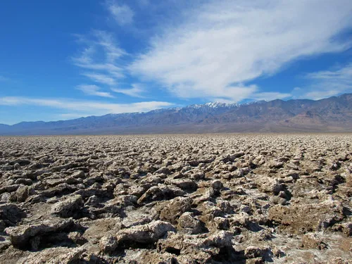
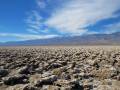
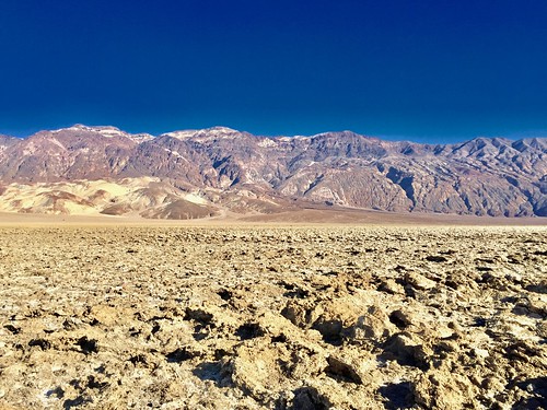
Exploring Devils Golf Course
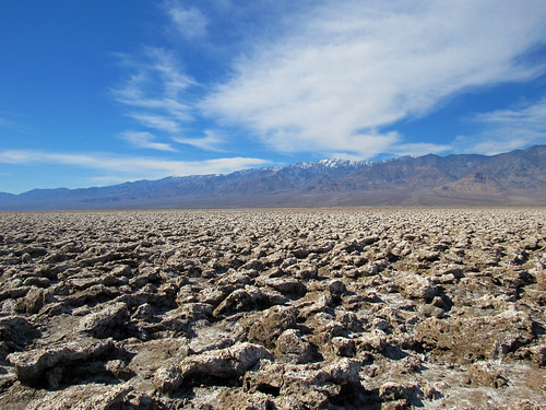
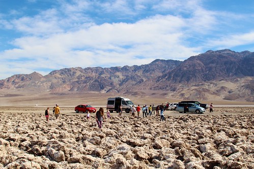
Devils Golf Course really isn’t a trail as much as it is an exploration. Most people get out of their cars, see the salt formations right up next to the parking area, get back in their cars, and continue on their way.

There’s nothing wrong with this, especially if you’re trying to see as much of Death Valley as possible in a day. But if you really want to see the real Devils Golf Course, you’re going to have to walk. And walking isn’t exactly easy.

Basically, you want to head out into the rock formations. It doesn’t matter which way you go as long as you get away from the parking area. It’s not like you’re going to get too lost out here – the cars are visible from quite a distance away.
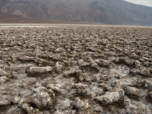
The rocks and salt formations have been trodden upon, touched, or accidentally knocked into by far too many tourists – so the further you walk, the more interesting formations you’ll find.
Walking amongst the rocks isn’t easy, and certainly walking through a real golf course is easier. Watch your footing to not accidentally step on formations, and watch your legs so that you don’t cut yourself on the rocks.

When you’ve had enough of the salt formations (or enough of the heat and sun!) return to your vehicle. Devils Golf Course is not a long stop, but it’s also pretty cool!
1 thought on “Devils Golf Course – Death Valley National Park”