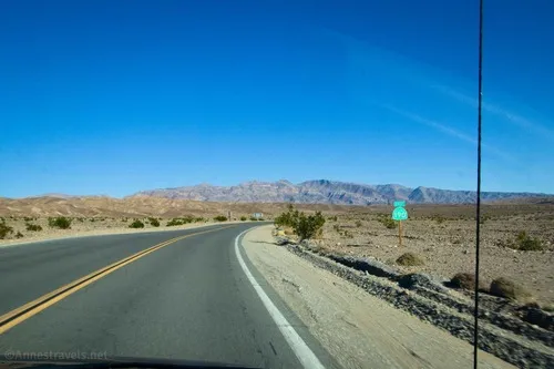
CA-190: Furnace Creek to Stovepipe Wells – Death Valley National Park


The main road through Death Valley between Furnace Creek and Stovepipe Wells. This guide begins where CA-190: Eastern border to Furnace Creek leaves off at Stovepipe Wells and connects to CA-190: Stovepipe Wells to Western Border.
| Total Distance: 24.2 miles point to point | Elevation Gain: 1,049ft. up, 886ft. down (-249ft. to 150ft.) |
| Road Difficulty: 0.6 | Bicycle Difficulty: Easiest |
| View Rating: 3.0 out of 5.0 stars | Rating: 3.0 out of 5.0 stars |
| Visitor Rating: (Click to rate) [Total: 0 Average: 0] | Visitor Difficulty Rating: (Click to rate) [Total: 0 Average: 0] |
| Pets: Leashed | Horses: No |
| Best Seasons: October-May | Special Permits: None |
| Water Availability: Water is available 24/7 at the Furnace Creek Visitor Center and also in Stovepipe Wells | Overnight Options: Campgrounds and lodging are available south of Furnace Creek and in Stovepipe Wells |
| Amenities: Water and services in Furnace Creek and Stovepipe Wells | Crowd Factor: Crowded |
| Uses: | Road surface: |
| Features: | Hazards: |
Mile-by-Mile: CA-190 Furnace Creek to Stovepipe Wells
Note: The mileage in parentheses (for example, (30.1)) are the mileage from where CA-190 begins at Death Valley Junction. For the post about CA-190, Death Valley Junction to Furnace Creek, click here.
0.0 (30.1) Airport Road on Left (West) (-183ft.). Turn left to access the Furnace Creek Visitor Center. To continue on CA-190, continue straight (north). Pass two paved driveways on the left, then a sometimes-gated gravel road on the right (overflow parking for the visitor center), a service road on the right, then an often-closed entrance to the Furnace Creek Campground on the left. Pass one more private road on the right. (36.460838°, -116.865494°)
1.3 (31.4) Harmony Borax Works/Mustard Canyon Access Road on left (-232ft.). Continue straight on the main road. You will pass the end of the Mustard Canyon Road 0.7 miles later. (36.480014°, -116.869445°)
3.0 (33.1) Cow Creek Road on right (-207ft.). This is the housing for the national park service employees as well as administrative buildings. Continue straight on the main road. (36.501905°, -116.875489°)
10.7 (40.8) Beatty Cutoff Road on right (-199ft.). The Beatty Cutoff is access to the Keane Wonder Mine as well as a shortcut to Daylight Pass and the town of Beatty. Continue straight (left) on the main road as it swings west. (36.588024°, -116.943335°)
13.0 (43.1) Salt Creek Road on left (-188ft.). Continue straight on the main road. (36.604713°, -116.980504°)
17.1 (47.2) Scotty’s Castle Road (North Highway) on right (110ft.). Scotty’s Castle Road is access to the northern part of the park, including Ubehebe Crater, Scotty’s Castle, and the Daylight Pass Road. Continue straight on the main road, which turns southwest. (36.639016°, -117.036122°)
19.7 (49.8) Devils Cornfield (-70ft.). The Devils Cornfield is an expanse of the valley bottom where Arrowweed grows. Wind blows soil around the bases of the plants, making the plants grow taller, resulting in a “field” that looks like it is filled with shocks of harvested corn. Continue on the main road. (36.616273°, -117.071871°)
22.0 (52.1) Grotto Canyon Road on left (-6ft.). The road to the canyon is rough and recommended for high clearance vehicles only (4×4 in some places). Continue on the main road. (36.604334, -117.105633)
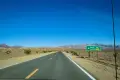
22.5 (52.6) Mesquite Sand Dunes Access Road on right (-10ft.). Continue straight on the main road. (36.605533°, -117.113746°)
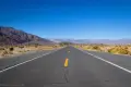
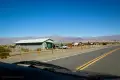
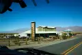
24.2 (54.3) Stovepipe Wells Ranger Station on right (-21ft.). This guide leaves off here to pick up in “CA-190: Stovepipe Wells to US-395.” Note that by traveling 0.4 miles further, you can reach the road to the popular Mosaic Canyon. (36.607798°, -117.144234°)
History & More
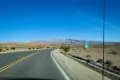
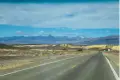
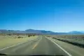
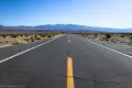
This part of CA-190 passes between the Funeral Mountains and Cottonball Basin before turning west to go across the top of the basin and over toward the Panamint and Cottonwood Mountains.
Furnace Creek holds the record for the hottest recorded air temperature on earth – 134°F (56.7°C) on July 10, 1913. It also holds the record for the highest recorded natural ground surface temperature on Earth – 201°F (93.9°C) on July 15, 1972.
The Harmony Borax Works were built by William T. Coleman after he purchased the borax claims from Aaron and Rosie Winters. Borax was collected from the valley floor, then mixed with water and carbonate of soda. The borax crystallized on suspended metal rods at the refinery. The purified borax was then shipped out via the famous “20 Mule Team.” The method worked well in the fall, winter, and spring, but the scorching summer heat made the water too hot for the borax to crystallize. The Harmony Borax Works were used from 1883 to 1888, when Mr. Coleman sold his company to Francis Marion Smith.
Salt Creek Pupfish are only found in the water of Salt Creek. These fish are very rare but are able to adapt to the changing environment of the salt marsh. In winter, the fish spawn, then the fish move closer to the spring to avoid being trapped in quickly evaporating pools of water.
The Mesquite Sand Dunes have been used as the backdrop in many movies and television shows, including Star Wars Episode IV: A New Hope and Star Wars Episode VI: The Return of the Jedi. In the later, the dunes were used as the filming location for C3PO and R2D2’s desert walk through Tatooine.
In 1948, park ranger and songwriter Stan Jones ( “Ghost Riders in the Sky”) supervised the filming of John Ford’s “3 Godfathers” movie. The ranger was on-site to make sure no park rules were broken in the process of filming. Stan also informed John Ford that he wouldn’t get any kind of water out of the cactus he was using for survival on-camera. At first rather offended by the park ranger’s interruption, John became friends with Stan and the two conducted profitable business for many years.
Download Road Map
Coming soon!
Trailhead Location
Eastern terminus: Furnace Creek Visitor Center, 30.1 miles west of Death Valley Junction (Amargosa Opera House) and 1.3 miles west of Badwater Road.
Western terminus: Stovepipe Wells, 30.6 miles east of Panamint Springs and 75.8 miles east of US-395.
Driving Directions
From the east, see CA-190: Death Valley Junction to Furnace Creek
From the west, see CA-190: Stovepipe Wells to Western Border
Leave No Trace Principles are enforced
Drones and model aircrafts are prohibited
Camping is permitted only in designated sites or in areas open to dispersed backcountry camping
Click here for all park rules and regulations
12 Month Pass: $55/Death Valley Annual Pass (valid at Death Valley National Park). $80/America the Beautiful Annual Pass (valid at all national park and federal fee areas). $20/Annual Senior Pass (62 years or older US citizens; valid at all national park and federal fee areas). Free/4th Grade Pass (Valid Sept. 1-August 31 of the child’s 4th Grade school year). Free/Military Pass (valid for all active military personel and their dependents with a CAC Card or DD Form 1173).
Lifetime Pass: $80/Lifetime Senior Pass (62 years or older US citizens; valid at all national park and federal fee areas). Free/Access Pass (available to all US citizens with perminent disabilities). Free/Access for Veterans and Gold Star Families Pass (valid for all military and veterans with a CAC card, Veteran HJealth Identification Card, Veteran ID Card, or veteran’s designation on state-issued drivers license or identification card.)
7 thoughts on “CA-190: Furnace Creek to Stovepipe Wells – Death Valley National Park”