Scotty’s Castle Road/North Highway – Death Valley National Park


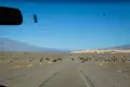

Paved road that travels north from the main part of Death Valley, up past Scotty’s Castle and Grapevine Canyon, and eventually to US-95 in Nevada. The road offers access to Fall Canyon/Titus Canyon Narrows, Ubehebe Crater, and other exploration opportunities.
| Total Distance: 62.3 miles point to point | Elevation Gain: 4,957ft. up, 1,000ft. down (-26ft. to 4,186ft.) |
| Road Difficulty: 0.6 | Bicycle Difficulty: More Difficult |
| View Rating: 3.0 out of 5.0 stars | Author’s Rating: 3.0 out of 5.0 stars |
| Visitor Rating: (Click to rate) [Total: 0 Average: 0] | Visitor Difficulty Rating: (Click to rate) [Total: 0 Average: 0] |
| Pets: Leashed | Horses: No |
| Best Seasons: October-May | Special Permits: None |
| Water Availability: Water is available at the Mesquite Spring Campground (mile 32.7) and the Grapevine Ranger Station (mile 33.25) | Overnight Options: Mesquite Spring Campground is located south of the Grapevine Ranger Station at mile 32.7. |
| Amenities: Restroom facilities at an informative kiosk (mile 0.7), the Grapevine Ranger Station (mile 33.25), and Scotty’s Castle (mile 36.4) | Crowd Factor: Moderate |
| Uses: | Road surface: |
| Features: | Hazards: |
Mile-by-Mile: Scotty’s Castle Road (North Highway)
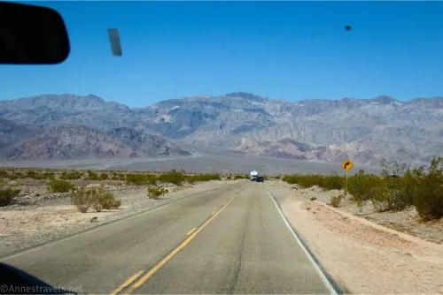
0.0 Scotty’s Castle Road (North Highway) junction with CA-190 (107ft.). Drive north/northwest following the sign toward Scotty’s Castle. (36.639016°, -117.036122°)
0.6 Daylight Pass Road on right (east) (166ft.). This is the most frequently used east exit from the northern part of Death Valley. Continue northwest (straight) on Scotty’s Castle Road. Just after this junction, a kiosk on the right (east) has a primitive restroom and a couple of picnic tables along with information. Soon after the kiosk, a gate can be closed if road conditions do not allow for access to the northern reaches of the road (usually due to flash flood danger or damage). (36.646364°, -117.041404°)
3.0 Road to the Historic Stovepipe Well on left (south) (71ft.). Continue straight on the main road. (36.668894°, -117.073931°)
11.9 Geological Marker on right (east) (136ft.). Pull over to read the “Aprons of Rock” kiosk if you wish before continuing north on the main road. (36.778759°, -117.141117°)
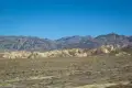
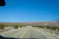
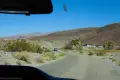
14.9 Titus Canyon Road on right (east) (178ft.). The road through Titus Canyon is one-way, north to south. However, the southern end of the road is two-way up to the mouth of Titus Canyon and the Fall Canyon Trailhead. Continue northwest on the main road. The junctions after this are non-existent for a long way, but the scenery is pretty. On the right is the Grapevine Mountains; to the left are the Cottonwood Mountains. (36.787706°, -117.191546°)
32.7 Mesquite Campground Road on left (west) (2,180ft.). Continue north on the main road. (36.989978°, -117.363086°)
33.0 Service Road on right (east) (2,209ft.). Continue on the main road. Pass a second service area, also on the right. (36.993646°, -117.364167°)
33.25 Grapevine Ranger Station/Entrance Station (2,257ft.). Continue up the road. (36.996272°, -117.365707°)
33.4 Ubehbe Crater Road on left (northwest) (2,297ft.). Continue straight on the Scotty’s Castle Road, which turns sharply right (east) up Grapevine Canyon. In 2015, this was the site of a massive flash flood that destroyed much of the road. Note that as of 2025, Scotty’s Castle Road beyond this junction is closed to all traffic (including vehicles and pedestrians). (36.998538°, -117.366640°)
36.4 Scotty’s Castle on left (3,016ft.). Continue straight on the main road. (37.031094°, -117.340108°)
40.9 Nevada/California State Border (3,942ft.). This is also the border of Death Valley National Park. Continue on Scotty’s Castle Road (now NV-267). (37.060471°, -117.285817°)
62.3 US-95 (4,063ft.). This is the north end of Scotty’s Castle Road, better known as Scotty’s Junction. (37.298773°, -117.053232°)
History & More
Scotty’s Castle Road was named after the famous “Scotty’s Castle” in Grapevine Canyon. Ironically, it is neither a castle nor did it belong to Scotty.
Much of the road was damaged in 2015 when a massive flash flood tore down Grapevine Canyon, forcing the evacuation of the Mesquite Campground. The road was damaged again in 2022 when the park received 75% of its yearly rainfall in 3 hours. As of 2025, the park has no date for reopening the road – or Scotty’s Castle.
In recent years, Scotty’s Castle Road has begun to be called North Highway. Whether or not this name change came about due to the castle having been closed for over 10 years is a subject for debate (or maybe I just haven’t run across the right informational resource yet?)
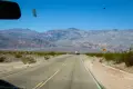
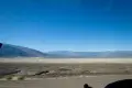
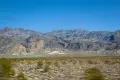
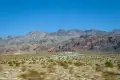
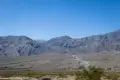
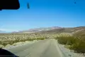
The Scotty’s Castle Road traverses the northern part of Death Valley between the Grapevine Mountains (east) and the Cottonwood Mountains (west).
Download Trail Map
Coming soon!
Driving Directions
The southern end of the road is 7.1 miles east of Stovepipe Wells along CA-190 and 17.1 miles north of the Furnace Creek Visitor Center. The northern terminus is at Scotty’s Junction on US-95, about 35 miles north of Beatty and 58 miles south of Tonopah.
Remember, it may be easier to climb up dryfalls than down them (or vice versa). Be sure you can climb in the other direction before climbing up or down a dryfall.
Leave No Trace Principles are enforced
Drones and model aircrafts are prohibited
Camping is permitted only in designated sites or in areas open to dispersed backcountry camping
All park rules and regulations
12 Month Pass: $55/Death Valley Annual Pass (valid at Death Valley National Park). $80/America the Beautiful Annual Pass (valid at all national park and federal fee areas). $20/Annual Senior Pass (62 years or older US citizens; valid at all national park and federal fee areas). Free/4th Grade Pass (Valid Sept. 1-August 31 of the child’s 4th Grade school year). Free/Military Pass (valid for all active military personel and their dependents with a CAC Card or DD Form 1173).
Lifetime Pass: $80/Lifetime Senior Pass (62 years or older US citizens; valid at all national park and federal fee areas). Free/Access Pass (available to all US citizens with perminent disabilities). Free/Access for Veterans and Gold Star Families Pass (valid for all military and veterans with a CAC card, Veteran HJealth Identification Card, Veteran ID Card, or veteran’s designation on state-issued drivers license or identification card.)
13 thoughts on “Scotty’s Castle Road/North Highway – Death Valley National Park”