Gold Valley Road – Death Valley National Park


Follow a 4×4 track off of the Greenwater Valley Road through the Black Mountains to Willow Spring and Gold Valley.
| Total Distance: 13.0 miles point-to-point (dead end) | Elevation Gain: 1,432ft. up, 1,877ft. down (4,479ft. to 2,637ft.) |
| Road Difficulty: 2.0 (4×4 required) | Bicycle Difficulty: More Difficult |
| View Rating: 4.0 out of 5.0 stars | Author’s Rating: 3.0 out of 5.0 stars |
| Visitor Rating: (Click to rate) [Total: 0 Average: 0] | Visitor Difficulty Rating: (Click to rate) [Total: 0 Average: 0] |
| Pets: Leashed | Horses: Yes |
| Best Seasons: October-May | Special Permits: None |
| Water Availability: None | Overnight Options: Yes; camp at least 200 yards from the spring and 1 mile from the Greenwater Valley Road |
| Amenities: None | Crowd Factor: Solitude |
| Uses: | Road surface: |
| Features: | Hazards: |
Mile-by-Mile: Gold Valley Road
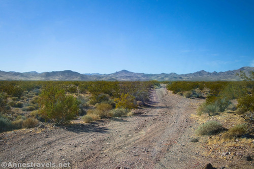
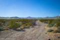
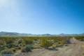
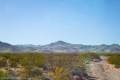
0.0 Gold Valley Road on the Greenwater Valley Road (3,093ft.). Turn west onto the gravel road as it heads for the distant mountains. The road travels across the desert with plenty of greasebushes before turning south at what looks to be an old road junction about mile 2.5. From here, it climbs into the mountains. Washes in this section may create difficult washouts. Keep your eyes open for the Panamint Mountains peeking through between the hills of the Black Mountains (which you’re in right now). The road follows washes for a bit before traversing a narrow valley through the mountains. Pass what appears to be a campsite about mile 7.5. The road descends after this. (36.055750°, -116.507392°)
8.0 Road Junction on left (west) (4,259ft.). Take the main right road to go straight (north). The left road would take you around to rejoin the main road via several prospects (and is part of the route to Smith Mountain), but it’s safer to take the main road. Drive down into the openness of Gold Valley. (36.021510°, -116.622747°)
9.6 Road Junction on right (north) (3,699ft.). Continue straight (left/west) on the main road. (The sideroad leads up to some old prospects.) Keep driving west and then north as you enter Gold Valley and begin descending via a wash. (36.039260°, -116.632954°)
11.1 Road Junction on left (south) (3,250ft.). Continue straight (right/west) on the main road. (The sideroad is the return of the road you didn’t take at mile 8.0.) Continue to follow the wash downhill. (36.045609°, -116.658738°)
13.0 End of Road (2,637ft.). The road ends in a small loop. From here, you may be able to scramble down to the spring, but heavy vegetation makes it difficult. Keep your eyes open for wildlife in the area, especially bighorn sheep. (36.049086°, -116.688731°)
History & More
Gold Valley received its name from rumors of boulders the size of houses filled with gold. This struck off a gold rush to the valley. There was gold to be found in the region; some miners made as much as $50/day ($1,400 in 2020). Rumors and passion ran so high that, it was said, a miner couldn’t even take off time to bathe without a claim jumper taking over. Today, nothing of note remains from the days of the gold boom.
Willow Spring was a major reason the gold prospectors survived. In a land as parched as Death Valley, an easy and reliable water source was even more precious than the gold the miners searched for.
Before the gold boom hit Gold Valley, it was the center of a copper rush. Then, just a year later, a second boom took the valley by storm with the discovery of silver. Finally, gold miners took over.
Some hikers like to begin trekking down Willow Canyon from Gold Valley. It’s a difficult trek with many downclimbs (ropes required; it’s so rarely done that the bolts may not be usable) and puddles at least ankle-deep before reaching the Willow Canyon Trail below the seasonal waterfall that will take you down to the Badwater Road. You can read more about this option here: https://www.stavislost.com/hikes/trail/willow-creek-canyon
The road is fairly rough, so 4×4 is recommended. Bushes grow in the middle of the road, and some obstacles make high clearance a definite asset. The road is also narrow – it would be difficult to pass a vehicle in most places!
It’s said that Willow Spring is a fantastic place to see wildlife, especially bighorn sheep.
Some people descend through Sheep Canyon from here by scrambling up to the saddle to the north of the parking area. Don’t attempt this without significant bouldering experience and only if you’re used to following maps through the desert.
Download Route Map
Driving Directions
The Gold Valley Road begins on the Greenwater Valley Road, 17.7 miles south of Dantes View Road and 10.6 miles north of Jubilee Pass Road.
It is extremely dangerous to enter a mine due to unstable shafts, gasses, and more. Do not enter mines, even if they are apparently open!
Walking on, climbing, entering, ascending, descending, or traversing any mine, structure, feature, or ruin is prohibited.
Toxic chemicals or ore may be present around mine sites. Enter at your own risk.
Possessing, destroying, injuring, defacing, removing, digging, or disturbing any mine, structure, feature, or ruin is also prohibited.
Always be wary of flash floods in a canyon.
Camping in a canyon is discouraged due to the danger of flash floods.
Remember, it may be easier to climb up dryfalls than down them (or vice versa). Be sure you can climb in the other direction before climbing up or down a dryfall.
Camping is not allowed within one mile of a paved road, developed area, or dirt road that is closed to camping.
Camping is not permitted within 100 feet of a flowing stream, spring, or other natural body of open water.
No camping is permitted on the floor of Death Valley, within one mile of Darwin Falls and Greenwater Canyon, on the active/shifting sand dunes, and certain other canyons and backcountry areas.
Camping is also prohibited within one mile of the Ubehebe Lead Mine, Leadfield Mines, Keane Wonder Mill, and Skidoo Mill.
Camping is limited to 30 days per calendar year within the park.
Fires are permitted in NPS-provided fire grates or grills ONLY.
Leave No Trace Principles are enforced
Drones and model aircrafts are prohibited
Camping is permitted only in designated sites or in areas open to dispersed backcountry camping
All park rules and regulations
12 Month Pass: $55/Death Valley Annual Pass (valid at Death Valley National Park). $80/America the Beautiful Annual Pass (valid at all national park and federal fee areas). $20/Annual Senior Pass (62 years or older US citizens; valid at all national park and federal fee areas). Free/4th Grade Pass (Valid Sept. 1-August 31 of the child’s 4th Grade school year). Free/Military Pass (valid for all active military personel and their dependents with a CAC Card or DD Form 1173).
Lifetime Pass: $80/Lifetime Senior Pass (62 years or older US citizens; valid at all national park and federal fee areas). Free/Access Pass (available to all US citizens with perminent disabilities). Free/Access for Veterans and Gold Star Families Pass (valid for all military and veterans with a CAC card, Veteran HJealth Identification Card, Veteran ID Card, or veteran’s designation on state-issued drivers license or identification card.)