Ubehebe Crater Road – Death Valley National Park


Drive a paved road up to the Ubehebe Crater Trailhead and the beginning of the Racetrack Road.
| Total Distance: 6.25 miles point to point | Elevation Gain: 666ft. up, 490ft. down (2,023ft. to 2,691ft.) |
| Road Difficulty: 0.8 | Bicycle Difficulty: Easy |
| View Rating: 3.0 out of 5.0 stars | Author’s Rating: 3.0 out of 5.0 stars |
| Visitor Rating: (Click to rate) [Total: 0 Average: 0] | Visitor Difficulty Rating: (Click to rate) [Total: 0 Average: 0] |
| Pets: Leashed | Horses: No |
| Best Seasons: October-May | Special Permits: None |
| Water Availability: None. The closest water is at the Grapevine Ranger Station south on Scotty’s Castle Road | Overnight Options: None |
| Amenities: None | Crowd Factor: Moderate to Crowded |
| Uses: | Road surface: |
| Features: | Hazards: |
Mile-by-Mile: Ubehebe Crater Road
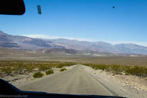
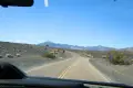
0.0 Ubehebe Crater Road Junction on Scotty’s Castle Road (2,297ft.). Drive northwest on Ubehebe Crater Road, following the sign for Ubehebe Crater 5 (as in, the crater is in 5 miles). (36.998538°, -117.366640°)
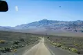
2.8 Death Valley Road Junction on right (2,091ft.). The dirt road to the right (east) is signed for Eureka Dunes and Big Pine. Continue left (west) on the paved road, following the arrow for the Ubehebe Crater. The road swings west and begins ascending to the top of the crater while the surrounding scenery becomes more volcanic. (37.017841°, -117.411404°)
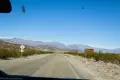
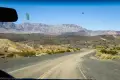
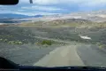
5.3 Road split (2,477ft.). The road turns right and becomes a one-way loop. (37.014318°, -117.453842°)
5.7 Racetrack Road Junction on right (2,499ft.). Continue straight (left) on the paved road. (37.012849°, -117.457854°)
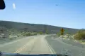
6.0 Ubehebe Crater Trailhead (2,591ft.). Stop to hike around the crater area (or just look at the signs at the overlook). The road continues down to the road split to become two-way traffic and return to Scotty’s Castle Road (North Highway). (37.010934°, -117.454963°)
History & More
On the night of October 18, 2015, Death Valley National Park received 2.75 inches of rain. In perspective, that’s approximately a years’ worth of rain in only 5 hours. Flash floods tore down Grapevine Canyon and many other canyons in the park, causing flooding and extensive damage to infrastructure. After receiving a distress signal, park rangers quickly evacuated the Mesquite Campground up onto the rim of Ubehebe Crater to escape the flooding. About 20 visitors and park staff sheltered atop the crater for the remainder of the night and then helped the visitors leave the area via the heavily damaged Scotty’s Castle Road the following morning.
The Death Valley Road is a high clearance only unpaved road. It’s a fun adventure with Joshua trees, mountains, mining areas, and more.
The Racetrack Road is another very rough adventure. While 4×4 is encouraged, it’s sometimes tackled by 2WD, high clearance vehicles. The road runs on rocky tread through Joshua Trees to a remote area of the park, including the Racetrack Playa and several old mines.
Ubehebe is pronounced “YOO-bee-HEE-bee.”
Download Trail Map
Coming soon!
Driving Directions
From the northeast, take US-95 to Scotty’s Castle Road (North Highway) (NV-267 at that point). Turn south for 28.9 miles to the road junction, on the right (the junction is 3 miles southwest of Scotty’s Castle).
From the southeast, take CA-190 to Scotty’s Castle Road (North Highway). Drive north for 33.4 miles to the junction for Ubehebe Crater, 0.2 miles beyond the Grapevine Ranger Station/Entrance Station. If coming from the Daylight Pass Road, turn right on the Scotty’s Castle Road(North Highway) and drive 32.8 miles.
Leave No Trace Principles are enforced
Drones and model aircrafts are prohibited
Camping is permitted only in designated sites or in areas open to dispersed backcountry camping
Click here for all park rules and regulations
12 Month Pass: $55/Death Valley Annual Pass (valid at Death Valley National Park). $80/America the Beautiful Annual Pass (valid at all national park and federal fee areas). $20/Annual Senior Pass (62 years or older US citizens; valid at all national park and federal fee areas). Free/4th Grade Pass (Valid Sept. 1-August 31 of the child’s 4th Grade school year). Free/Military Pass (valid for all active military personel and their dependents with a CAC Card or DD Form 1173).
Lifetime Pass: $80/Lifetime Senior Pass (62 years or older US citizens; valid at all national park and federal fee areas). Free/Access Pass (available to all US citizens with perminent disabilities). Free/Access for Veterans and Gold Star Families Pass (valid for all military and veterans with a CAC card, Veteran HJealth Identification Card, Veteran ID Card, or veteran’s designation on state-issued drivers license or identification card.)
8 thoughts on “Ubehebe Crater Road – Death Valley National Park”