Lee’s Camp Road – Death Valley National Park


Rough gravel/dirt road through mining country in the Funeral Mountains and past Lee’s Camp to a point near the “town” of Amargosa Valley.
| Total Distance: 18.2 miles point-to-point | Elevation Gain: 1,658ft. up, 2,849ft. down (2,381ft. to 4,857ft.) |
| Road Difficulty: 2.5+; 2.0 for southern 3 miles; 1.6 for northern 7.6 miles | Bicycle Difficulty: Very Difficult |
| View Rating: 3.0 out of 5.0 stars | Author’s Rating: 2.0 out of 5.0 stars |
| Visitor Rating: (Click to rate) [Total: 0 Average: 0] | Visitor Difficulty Rating: (Click to rate) [Total: 0 Average: 0] |
| Pets: Leashed | Horses: Yes |
| Best Seasons: October-May | Special Permits: None |
| Water Availability: None | Overnight Options: Yes in Death Valley National Park |
| Amenities: None | Crowd Factor: Solitude |
| Uses: | Road surface: |
| Features: | Hazards: |
https://www.walkingwildandfree.com/wp-content/uploads/2023/06/Lees-Camp-Road.gpx
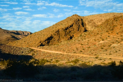
Mile-by-Mile: Lee’s Camp Road
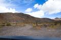
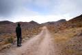
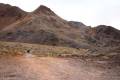
0.0 Lee’s Camp Road Junction on the Echo Canyon Road (3,583ft.). Turn north on the road to Lee’s Camp (toward Amargosa). The route is rough but not too bad for the first 3 miles (should be ok for stock vehicles; as always, don’t do something you’re not comfortable with – help is many miles away). The road rises steeply to a pass, then takes a long switchback down into the wash. At the end of the switchback, old maps show an old (closed) road heading west over toward the townsite of Schwab. About mile 0.75, a road on left goes to an old prospect. (36.496308°, -116.710683°)
2.1 Parking area on right (south) (4,070ft.). A trail or closed road leads south and west from here to the back side of the Inyo Mine. The mine area is private property. Continue along the road. Before and after this waypoint, there are many old audits and prospects visible. (36.503091°, -116.693486°)
2.6 Mining road on right (east) (4,204ft.). Continue north on the main road. The side road goes a short distance up to what appears to be a prospect. Pass another side road on the right (again, a short spur up to a prospect) about mile 2.9. (36.506925°, -116.687879°)
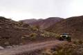
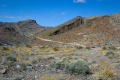
3.0 First difficult section (4,340ft.). This section of the road is very difficult with steps and boulders. It will require a narrow wheelbase with a lift kit and may result in vehicle damage. You should be proficient in off-roading before attempting the obstacles; spotters are helpful. Once beyond the obstacles, continue driving up the canyon. Less than a quarter mile beyond the beginning of the difficult section, a canyon on the right can be walked a short distance to a smooth dryfall. (36.510794°, -116.683908°)
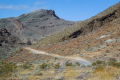
3.5 Spur roads (4,513ft.). Spur roads go off on the right and straight. While the right (south) road is fairly short to a prospect, the straight road up the canyon (east) comes to obstacles fairly quickly. Turn north (left) on the main road. (36.514106°, -116.678978°)
3.6 Spur roads (4,648ft.). Roads go right and left (east and west). The right road is short, but the left (west) road leads to a true network of old mining roads. It’s said that the left spur is very narrow, tilted, sketchy, and difficult to drive. Continue north (straight) on the main road. (36.516474°, -116.678530°)
4.2 Spur roads on left (4,808ft.). Continue straight on the main road. Another spur goes off on the left a quarter of a mile later. You’re nearing the high point of the road, where it descends into a wash and turns left to take the wash downhill. (36.523184°, -116.674043°)
6.6 Second difficult section (4,220ft.). You’re going downhill, so it’s likely easier than the first section, but it’s still very technical, and spotters are advised. This part of the canyon is very narrow, which means you’ll need to be driving a fairly narrow vehicle to make it through. The canyon eventually widens out and continues north. (36.542428°, -116.681768°)
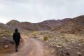
9.4 Spur on left (3,407ft.). Continue right on the road in the canyon. About mile 10, the wash makes a sharp turn to the east. The road turns with the wash and exits the wash 0.6 miles later to head northeast. (36.570864°, -116.688935°)
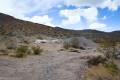
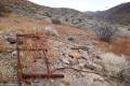
10.7 Spur road on right to Lee’s Camp Prospects (3,083ft.). This area may be of interest to explore, as there are a few foundations and historical junk. Continue straight on the main road, which beyond this point is suitable for high clearance, 2WD vehicles. Pass another spur road on the right a quarter mile later. (36.579562°, -116.670687°)
11.5 Spur to Lee’s Camp on left (north) (2,907ft.). Stay right on the main road. You may wish to explore the area for foundations and so on. (36.587914°, -116.661659°)
11.8 California/Nevada State Line (2,853ft.). This is also the border of Death Valley National Park. No camping is allowed beyond this point. (36.587283°, -116.656429°)
12.0 Spur road on left (north) (2,789ft.). This road will take you north to old prospects and the area around Indian Pass. Continue east on the main road. (36.588235°, -116.651810°)
14.3 Road (2,388ft.). Turn left. You will pass or cross a fair number of other roads; keep going straight. (36.583370°, -116.612545°)
18.2 North Valley View Road (2,391ft.). The road is paved. This is the end of this guide. To get to US-95, turn left (north) and drive 6.7 miles (you’ll come out just west of Amargosa Valley, where NV-373 meets US-95). To return to a main part of Death Valley, turn right on North Valley View Road to the next paved road (Amargosa Farm Road). Turn left to Death Valley Junction Road (NV-373) just south of US-95. Turn right (south) on NV-373 for 18.3 miles to Death Valley Junction and the connection to CA-190. (36.583296°, -116.542835°)
History & More
The road may be impassable when wet. Use care not to be trapped in the wash during a flash flood.
Rangers recommend that you travel this road as part of a caravan. If you break down or get stuck, the others in the group can help you out. The official National Park Service vehicles cannot access the narrower parts of the canyon, so rescue is unlikely.
It’s said that some parts of the canyon are so narrow that only the skinnier 4×4 vehicles can make it through.
When two rival mining camps sprung up – one in Nevada and another in California – both tried to horn the other out. Lee’s Camp on the California side of the state line won out with a rooming house, saloon, restaurant, and general store – or perhaps it was when the promoter of the town struck water only three miles east of the town.
The mining boom in this specific area was started by brothers Richard and Gus Lee, who found two gold ledges in late 1904. In its peak years, Lee, California, had 600 residents. When the panic of 1907 hit, mining slowed, and the shop proprietors began to move elsewhere. The post office closed in 1912, and the rest of the residents moved away.
Lee’s Camp was much closer to civilization than was its neighbor to the south, Schwaub and the Inyo Mine. Supplies could be brought to the town in less than a day, and everything that came and went from Schwaub had to pass through Lee. The local gold was also easier to transport to the railroads. Still, neither mine survived the panic of 1907. It’s very possible that there is still gold in the hills around Lee’s Camp.
Download Trail Map
Driving Directions
From CA-190, take the Echo Canyon Road for 9.0; turn onto Lee’s Camp Road. Alternately, to do the route backwards, from US-95, drive south on NV-373 for 5.2 miles; turn right onto E Amargosa Farm Road for another 7.2 miles. Turn right onto N Valley View Blvd. A mile later, turn left to begin at the end of this guide.
It is extremely dangerous to enter a mine due to unstable shafts, gasses, and more. Do not enter mines, even if they are apparently open!
Walking on, climbing, entering, ascending, descending, or traversing any mine, structure, feature, or ruin is prohibited.
Toxic chemicals or ore may be present around mine sites. Enter at your own risk.
Possessing, destroying, injuring, defacing, removing, digging, or disturbing any mine, structure, feature, or ruin is also prohibited.
Always be wary of flash floods in a canyon.
Camping in a canyon is discouraged due to the danger of flash floods.
Remember, it may be easier to climb up dryfalls than down them (or vice versa). Be sure you can climb in the other direction before climbing up or down a dryfall.
Camping is not allowed within one mile of a paved road, developed area, or dirt road that is closed to camping.
Camping is not permitted within 100 feet of a flowing stream, spring, or other natural body of open water.
No camping is permitted on the floor of Death Valley, within one mile of Darwin Falls and Greenwater Canyon, on the active/shifting sand dunes, and certain other canyons and backcountry areas.
Camping is also prohibited within one mile of the Ubehebe Lead Mine, Leadfield Mines, Keane Wonder Mill, and Skidoo Mill.
Camping is limited to 30 days per calendar year within the park.
Fires are permitted in NPS-provided fire grates or grills ONLY.
Leave No Trace Principles are enforced
Drones and model aircrafts are prohibited
Camping is permitted only in designated sites or in areas open to dispersed backcountry camping
All park rules and regulations
12 Month Pass: $55/Death Valley Annual Pass (valid at Death Valley National Park). $80/America the Beautiful Annual Pass (valid at all national park and federal fee areas). $20/Annual Senior Pass (62 years or older US citizens; valid at all national park and federal fee areas). Free/4th Grade Pass (Valid Sept. 1-August 31 of the child’s 4th Grade school year). Free/Military Pass (valid for all active military personel and their dependents with a CAC Card or DD Form 1173).
Lifetime Pass: $80/Lifetime Senior Pass (62 years or older US citizens; valid at all national park and federal fee areas). Free/Access Pass (available to all US citizens with perminent disabilities). Free/Access for Veterans and Gold Star Families Pass (valid for all military and veterans with a CAC card, Veteran HJealth Identification Card, Veteran ID Card, or veteran’s designation on state-issued drivers license or identification card.)
1 thought on “Lee’s Camp Road – Death Valley National Park”