Quail Colorful Canyon Loop – Death Valley National Park

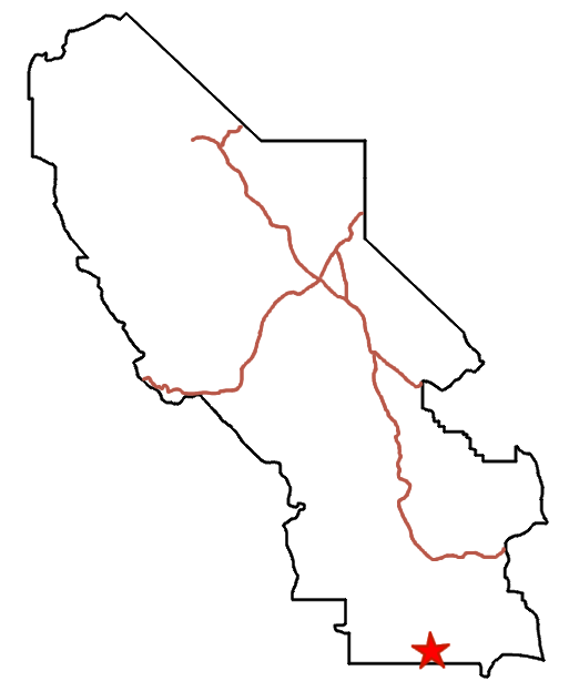




Exploration of two unnamed canyons in the Quail Mountains with narrows and colorful rocks.
| Total Distance: 4.8 mile loop | Elevation Gain: 793ft. (2,204ft. to 2,965ft.) |
| Difficulty: Moderate | 0-5 Mile Difficulty: Strenuous |
| View Rating: 5.0 out of 5.0 stars | Author’s Rating: 3.0 out of 5.0 stars |
| Visitor Rating: (Click to rate) [Total: 0 Average: 0] | Visitor Difficulty Rating: (Click to rate) [Total: 0 Average: 0] |
| Pets: No | Horses: Yes |
| Best Seasons: November-April | Special Permits: None (do not go south into the Fort Irwin Military Reservation) |
| Water Availability: None | Overnight Options: Dispersed camping permitted |
| Trailhead Amenities: None | Crowd Factor: Solitude |
| Trailhead Access: 2.0 4×4 appreciated, though high clearance may be ok in dry weather | |
Uses:     | Trail Surface:      |
Features:     | Hazards:         |
Mile-by-Mile: Quail Colorful Canyon Loop
0.0 Owl Hole Spring Road crosses a small arm of a wash (2,214ft.). Walk due south toward the Quail Mountains. Keep your eyes open for wild burros that frequent the area. You will be heading for some colorful hills at the base of the mountains. (35.674718°, -116.751398°)
0.5 Wash begins to narrow (2,333ft.). After about 0.4 miles, the wash will begin to become more defined and less of a floodplain; it will then veer slightly southwest. Follow the wash. Colorful canyons will begin to be visible after 1.3 miles. (35.667273°, -116.752063°)
1.5 Mouth of first colorful canyon (2,599ft.). Turn left (south/southeast) to follow a wash into the mountains. Just after the turn, you can optionally explore an out-and-back wash on the left up into the colorful rocks. Keep walking up the wash which fairly quickly becomes a canyon. Rocks of various colors showcase on the hillsides, especially white rock above darker rock. The canyon bottom may be difficult to navigate, as it is littered with boulders and smaller rocks. Occasional narrows make the hike even more fun. (35.655612°, -116.759479°)
2.0 Dryfall (2,810ft.). The dryfall is fairly easily navigated. Keep walking upcanyon. A short distance beyond the dryfall, the canyon seems to split; take the main right fork. (35.649876°, -116.756092°)
2.1 Amphitheater (2,846ft.). The canyon more or less ends in a large amphitheater, breaking into multiple smaller washes. The amphitheater showcases many colorful rocks. Unless you’d rather do the hike as an out-and-back trek, turn left to climb east and then southeast up the ridgeline and down into the next canyon to the east. (35.648659°, -116.755420°)
2.3 Second colorful canyon (2,863ft.). Turn left (east/northeast) to follow the canyon downstream. The hillsides are so colorful, they’re reminiscent of Artist Palette along the Badwater Road. Further down the canyon, the walls are colorful, and there are some impressive rock formations. (35.647923°, -116.752920°)
3.3 Mouth of second colorful canyon (2,461ft.). Continue walking down the wash. (35.658165°, -116.750572°)
4.1 Flood plain/turn northwest (2,246ft.). Turn and walk north-northwest to return to your vehicle. (35.667595°, -116.743909°)
4.8 Road crosses a small arm of a wash (2,214ft.). (35.674718°, -116.751398°)
History & More
Quail Canyon does not have an official name. In fact, in searching for it recently, Google was unable to find anything about it. Someday, I’d love to go out and explore it for myself. The canyon is named after the Quail Mountains in which it is located.
The colors in the badlands and rocks of Death Valley are formed from a mix of minerals, most of which are different forms of iron that have oxidized when exposed to the air. In general, Yellow Rock = Limonite, Purple Rock = Hematite, Red/Orange Rock = Hematite, and Green/Blue Rock = Chlorite or Nontronite.
Download Route Map
Driving Directions
The road begins along the Owl Hole Spring Road, 17.9 miles from its beginning at the junction with the Harry Wade Road. It is located 6.7 miles west of the Randsburg Road Junction.
Camping in a canyon is discouraged due to the danger of flash floods.
Remember, it may be easier to climb up dryfalls than down them (or vice versa). Be sure you can climb in the other direction before climbing up or down a dryfall.
Camping is not allowed within one mile of a paved road, developed area, or dirt road that is closed to camping.
Camping is not permitted within 100 feet of a flowing stream, spring, or other natural body of open water.
No camping is permitted on the floor of Death Valley, within one mile of Darwin Falls and Greenwater Canyon, on the active/shifting sand dunes, and certain other canyons and backcountry areas.
Camping is also prohibited within one mile of the Ubehebe Lead Mine, Leadfield Mines, Keane Wonder Mill, and Skidoo Mill.
Camping is limited to 30 days per calendar year within the park.
Fires are permitted in NPS-provided fire grates or grills ONLY.
Leave No Trace Principles are enforced
Drones and model aircrafts are prohibited
Camping is permitted only in designated sites or in areas open to dispersed backcountry camping
All park rules and regulations
12 Month Pass: $55/Death Valley Annual Pass (valid at Death Valley National Park). $80/America the Beautiful Annual Pass (valid at all national park and federal fee areas). $20/Annual Senior Pass (62 years or older US citizens; valid at all national park and federal fee areas). Free/4th Grade Pass (Valid Sept. 1-August 31 of the child’s 4th Grade school year). Free/Military Pass (valid for all active military personel and their dependents with a CAC Card or DD Form 1173).
Lifetime Pass: $80/Lifetime Senior Pass (62 years or older US citizens; valid at all national park and federal fee areas). Free/Access Pass (available to all US citizens with perminent disabilities). Free/Access for Veterans and Gold Star Families Pass (valid for all military and veterans with a CAC card, Veteran HJealth Identification Card, Veteran ID Card, or veteran’s designation on state-issued drivers license or identification card.)