Owl Lake – Death Valley National Park

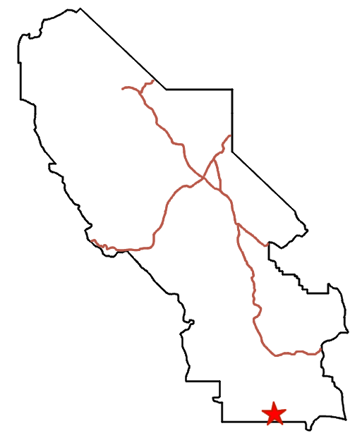




Follow washes to a dry lakebed below the Owlshead Mountains.
| Total Distance: 8.6 miles out & back | Elevation Gain: 456ft. (2,076ft. to 1,696ft.) |
| Difficulty: Moderate | 5-10 Mile Difficulty: Moderately Strenuous |
| View Rating: 3.0 out of 5.0 stars | Author’s Rating: 2.0 out of 5.0 stars |
| Visitor Rating: (Click to rate) [Total: 1 Average: 1] | Visitor Difficulty Rating: (Click to rate) [Total: 1 Average: 1] |
| Pets: No | Horses: Yes |
| Best Seasons: November-April | Special Permits: None. Do not walk on the playa if it is wet. |
| Water Availability: None | Overnight Options: Dispersed camping permitted |
| Trailhead Amenities: None | Crowd Factor: Solitude |
| Trailhead Access: 2.0 4×4 appreciated, though high clearance may be ok in dry weather | |
Uses:     | Trail Surface:     |
Features:   | Hazards:        |
Mile-by-Mile: Owl Lake
0.0 Wash crosses the Owl Hole Spring Road (2,076ft.). This is the first major wash that crosses the road after entering the plain after Sagenite Hill. Walk north, following the wash. The wash divides many times; it doesn’t matter a lot which fork you take as long as it’s a fairly major wash – as most roads lead to Rome, so most washes in this area lead to Owl Lake. If you’re ever in doubt, head north and a little east and you’ll arrive at the lakebed. (35.6739037°, -116.7318219°)
4.3 Owl Lake (1,696ft.). The lake can be explored (do not walk on the playa if it is wet – your footprints could literally last decades). A green area may be found at the eastern end of the dry lake; sinkholes may also be filled with water after a recent rain. (35.723820°, -116.697228°)
History & More
Owl Lake isn’t actually a lake – it’s a dry lakebed. Many washes carry water here during storms, but it fairly quickly evaporates or sinks into the ground.
You may find some depressions in the surface of the lake. Some call these sinkholes, while others call them bomb craters created by military tests before this was part of the national park.
After a rain, the Owl Hole Spring Road is mostly impassible without excellent 4×4 – but the lake may be full of water!
Download Route Map
Driving Directions
The road begins along the Owl Hole Spring Road, 16.8 miles from its beginning at the junction with the Harry Wade Road. It is located 5.6 miles west of the Randsburg Road Junction.
Camping is not permitted within 100 feet of a flowing stream, spring, or other natural body of open water.
No camping is permitted on the floor of Death Valley, within one mile of Darwin Falls and Greenwater Canyon, on the active/shifting sand dunes, and certain other canyons and backcountry areas.
Camping is also prohibited within one mile of the Ubehebe Lead Mine, Leadfield Mines, Keane Wonder Mill, and Skidoo Mill.
Camping is limited to 30 days per calendar year within the park.
Fires are permitted in NPS-provided fire grates or grills ONLY.
Leave No Trace Principles are enforced
Drones and model aircrafts are prohibited
Camping is permitted only in designated sites or in areas open to dispersed backcountry camping
All park rules and regulations
12 Month Pass: $55/Death Valley Annual Pass (valid at Death Valley National Park). $80/America the Beautiful Annual Pass (valid at all national park and federal fee areas). $20/Annual Senior Pass (62 years or older US citizens; valid at all national park and federal fee areas). Free/4th Grade Pass (Valid Sept. 1-August 31 of the child’s 4th Grade school year). Free/Military Pass (valid for all active military personel and their dependents with a CAC Card or DD Form 1173).
Lifetime Pass: $80/Lifetime Senior Pass (62 years or older US citizens; valid at all national park and federal fee areas). Free/Access Pass (available to all US citizens with perminent disabilities). Free/Access for Veterans and Gold Star Families Pass (valid for all military and veterans with a CAC card, Veteran HJealth Identification Card, Veteran ID Card, or veteran’s designation on state-issued drivers license or identification card.)