Wingate Dry Lake from Owl Spring Road – Death Valley National Park
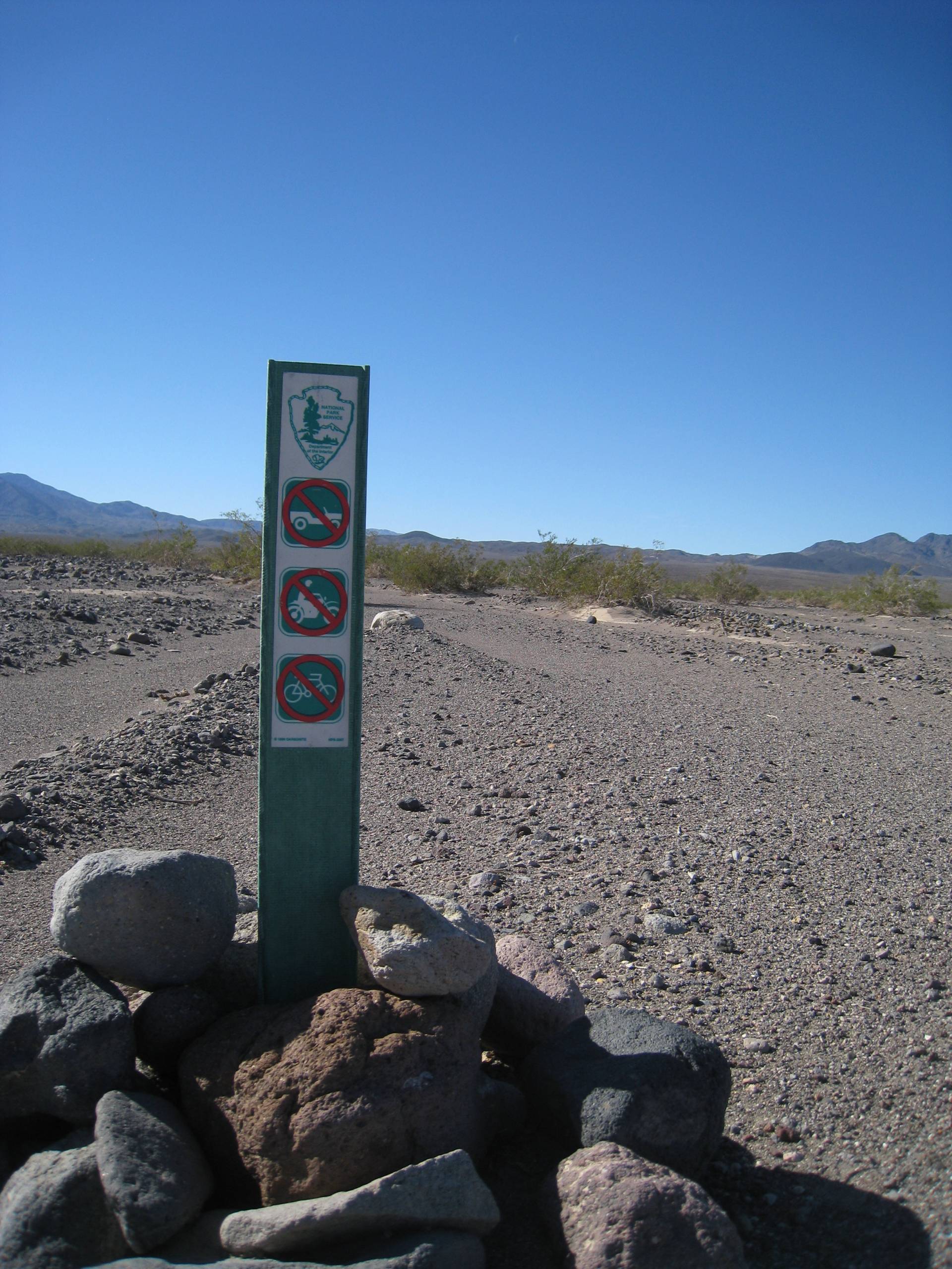

Photo credit The Greater Southwestern Exploration Company, CC BY 2.0. View at https://flic.kr/p/rtxcSt




An extremely long and remote hike takes you to a rarely visited dry lakebed.
| Total Distance: 18.4 miles out & back | Elevation Gain: 1,797ft. (3,310ft. to 1,686ft.) |
| Difficulty: Extremely Strenuous | 0-5 Mile Difficulty: Very Strenuous |
| View Rating: 4.0 out of 5.0 stars | Author’s Rating: 3.0 out of 5.0 stars |
| Visitor Rating: (Click to rate) [Total: 0 Average: 0] | Visitor Difficulty Rating: (Click to rate) [Total: 0 Average: 0] |
| Pets: No | Horses: Yes |
| Best Seasons: November-April | Special Permits: None. Do not trespass into the military reservation. |
| Water Availability: None | Overnight Options: Dispersed camping permitted |
| Trailhead Amenities: None | Crowd Factor: Solitude |
| Trailhead Access: 2.0 4×4 appreciated, though high clearance may be ok in dry weather | |
Uses:     | Trail Surface:    |
Features:   | Hazards:         |
Mile-by-Mile: Wingate Dry Lake from Owl Spring Road
0.0 Beginning of old road where the Owl Hole Spring Road turns sharply north (3,310ft.). The old road is marked by a sign indicating that it is under wilderness restoration; foot and horse traffic only. Follow the old road and the directions for the Epsom Salt Works until you hit the dirt road. (35.690860°, -116.907586°)
2.4 Dirt Road (2,701ft.). Somewhere along the way, you’ll run into this road (where exactly you come out on the road is definitely up to you). When you hit the road, turn right (northwest) on the road and follow it toward the Crystal Hills. To my knowledge, it is ok to walk on the road since it crosses public property. However, always follow the guidance of any signs and markers. Do not turn left (south) as the road quickly enters the military reservation. You may also see signs about protecting desert tortoises; there are many burrows in the area. The road at this point should turn left from heading mostly north (and a little east) to a definite northwest direction (if the road enters the hills, you’ve gone too far or – more likely – missed the turn in the road). Turn right, off the road, to continue on another old road (possibly vague or invisible) that heads generally north and a little east in the same trajectory as the road before it turned. (35.711272°, -116.930131°)
3.4 Old road turns left (northwest) to enter hills (2,629ft.). The road turns left here to pass through some hills via the wash, which begins approximately 35.726757°, -116.926169°. Continue to follow it through the hills and into the wash on the other side (the roadbed generally follows the right side of the wash). Once on the other side, the road heads pretty much due north (and a little east) – you may need to pick it up again approx. 35.737872°, -116.931446°. (35.7249611°, -116.9250556°)
5.5 Old Road turns right (northeast) (1,937ft.). The road turns right here to strike in a nearly straight line northeast. Note: At this point, you’re less than half a mile east of military land which may or may not be marked. Don’t trespass by wandering too far west. (35.754566°, -116.930795°)
7.25 Enter Wingate Wash (1,735ft.). While you could turn right to walk downstream, I’ll have you go due north to pick up the old Wingate Wash Road. (35.773199°, -116.910906°)
7.4 Wingate Wash Road (1,734ft.). Turn right to follow the old (but very defined) road. (35.775617°, -116.911209°)
8.6 Wingate Dry Lake (1,694ft.). The Wingate Wash Road seems to cross the lake, north to south. (35.789721°, -116.903900°)
9.2 North end of Wingate Dry Lake (1,688ft.). Retrace your steps to your vehicle or see the notes below. (35.797501°, -116.903248°)
History & More
Wingate Pass (and the road you’re following) was part of the route used by the 20 Mule Team while hauling borax to the rail line in Mojave.
There are two stories as to how Wingate Wash received its name. Some say that it was named in honor of Major Benjamin Wingate, who died during the Battle of Valverde in New Mexico in 1862. Others say the canyon is so gusty and windy that “wind gap” or “wind gate” was the name given by the 20 Mule Team Drivers who used the route through the mountains.
Wingate Dry Lake is technically known as “Dry Lake.” However, it’s a vague name, and much overused, so I’ve chosen to go with the colloquial name.
The old roads in this area may be easy or impossible to follow. The good news is that they tend to run in a straight line until they turn – and usually, I’ve marked out the turns for you. So if you can’t find the road, you can at least head straight for the next waypoint. There are two places where this doesn’t work out quite so well: 1) in the hills (keep following the wash and going north, and you’ll be fine), and 2) once you’re in Wingate Wash, you just need to follow the wash and much-more-visible road down (east and then north) into Wingate Dry Lake.
It is possible to walk north and east from the lakebed down Wingate Wash to the West Side Road or Warm Springs Road. However, this is an extremely long trek, so I’ve chosen to include this route as an out-and-back and the route to the Windgate Slot Canyons as an out-and-back, even though (with enough water, stamina, and backpacking experience) you could connect the two.
Remember that the Fort Irwin Military Reservation is just to the west of where you’re hiking. Be extremely careful to stay out of the military area (it’s not always marked). If you find unexploded ordnance or other strange debris lying around, do not approach them! Give your find a wide berth and continue on your way.
At the north end of the lake, you may find the old sign that once marked the boundary to Death Valley National Monument (it was made a national park in 1994). Another sign told visitors that guns were not permitted and no vehicles were allowed on the lakebed.
The Battle of Wingate Pass took place just north of Wingate Dry Lake. The short version of the story goes something like this (taking account that no one gave a full or completely accurate account of the day): Death Valley Scotty (of Scotty’s Castle) convinced several influential (and rich) investors and mining engineers that he had found an extremely profitable gold strike in southern Death Valley. It was all a hoax, and when the investors asked to see the mine, Scotty took them to a friend’s mine instead – it was smaller than he had suggested but still convincing. In a last-ditch effort to keep his story alive, he asked a friend to stage a shoot-out to scare the investors away from the mine. When they heard gunshots, Scotty assured his companions that he could fight off any outlaws. Warily pushing forward, the group was, indeed, shot at – and Scotty’s brother was badly wounded (it was an accident; it’s said that the friend was too drunk to shoot straight). Losing control of himself, Scotty raced toward the ambush, shouting at the men to stop shooting. The entire group hurriedly returned to civilization, where the wounded man was sent to Los Angeles, the investors returned home (including Albert M. Johnson, who would build Scotty’s Castle), the ambushmen made themselves very scarce, and Scotty hurried away to Seattle, where he was set to be the star of a production titled “Scotty, King of the Desert Mine.”
All might have simmered down – it wasn’t that uncommon for investors to be swindled – but the incident caught the attention of a news-hungry Los Angeles newspaperman. The main investor reported the facts – and suggested Scotty had intended to kill him – to the sheriff of San Bernardino County. Public outcry asked for Scotty and his friends to be arrested, and despite full houses (who doesn’t want to see a bandit in action from the safety of a theater seat?), Scotty was arrested, released, arrested two days later, released on bail, and pleaded not guilty of assault with a deadly weapon. He was arrested for the fourth time in two weeks, joined his cronies in jail, and was once again released the next day to join his acting troupe. The law dropped the case when it was proved that the incident had happened in Inyo County, just north of the San Bernardino county line.
Six years later, a court in Los Angeles convicted Scotty for refusing to pay his brother’s doctor’s bills – and at the same time, of his hoax involving the mine and the ambush. It’s even been said (and possibly proved) that Death Valley Scotty moved the county line six miles south just to drop the case or at least give himself more time.
Download Route Map
Driving Directions
The route begins along the Owl Hole Spring Road, 2.4 miles from the end of the road, and 16.2 miles west of the Randsburg Road Junction.
Camping in a canyon is discouraged due to the danger of flash floods.
Remember, it may be easier to climb up dryfalls than down them (or vice versa). Be sure you can climb in the other direction before climbing up or down a dryfall.
Camping is not allowed within one mile of a paved road, developed area, or dirt road that is closed to camping.
Camping is not permitted within 100 feet of a flowing stream, spring, or other natural body of open water.
No camping is permitted on the floor of Death Valley, within one mile of Darwin Falls and Greenwater Canyon, on the active/shifting sand dunes, and certain other canyons and backcountry areas.
Camping is also prohibited within one mile of the Ubehebe Lead Mine, Leadfield Mines, Keane Wonder Mill, and Skidoo Mill.
Camping is limited to 30 days per calendar year within the park.
Fires are permitted in NPS-provided fire grates or grills ONLY.
Leave No Trace Principles are enforced
Drones and model aircrafts are prohibited
Camping is permitted only in designated sites or in areas open to dispersed backcountry camping
All park rules and regulations
12 Month Pass: $55/Death Valley Annual Pass (valid at Death Valley National Park). $80/America the Beautiful Annual Pass (valid at all national park and federal fee areas). $20/Annual Senior Pass (62 years or older US citizens; valid at all national park and federal fee areas). Free/4th Grade Pass (Valid Sept. 1-August 31 of the child’s 4th Grade school year). Free/Military Pass (valid for all active military personel and their dependents with a CAC Card or DD Form 1173).
Lifetime Pass: $80/Lifetime Senior Pass (62 years or older US citizens; valid at all national park and federal fee areas). Free/Access Pass (available to all US citizens with perminent disabilities). Free/Access for Veterans and Gold Star Families Pass (valid for all military and veterans with a CAC card, Veteran HJealth Identification Card, Veteran ID Card, or veteran’s designation on state-issued drivers license or identification card.)