Owlshead Mountains Viewpoint/Black Magic Mine Road – Death Valley National Park




Rough dirt road to an old mine site with ruins and fantastic views of the Owlshead Mountains.
| Total Distance: 5.0 miles one-way (dead end) from the Owl Hole Spring Road | Elevation Gain: 1,689ft. (1,912ft. to 3,254ft.) |
| Road Difficulty: 2.5 | Bicycle Difficulty: Very Difficult |
| View Rating: 5.0 out of 5.0 stars | Rating: 4.0 out of 5.0 stars |
| Visitor Rating: (Click to rate) [Total: 0 Average: 0] | Visitor Difficulty Rating: (Click to rate) [Total: 0 Average: 0] |
| Pets: Leashed | Horses: Yes |
| Best Seasons: November-April | Special Permits: None (do not go south into the Fort Irwin Military Reservation) |
| Water Availability: None | Overnight Options: Dispersed camping permitted within NPS guidelines |
| Amenities: None | Crowd Factor: Solitude |
Uses:         | Road surface:    |
Features:    | Hazards: 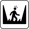          |
Mile-by-Mile: Owlshead Mountains Viewpoint/Black Magic Mine Road
0.0 Owlshead Mountains Viewpoint/Black Magic Mine Road Junction on the Owl Hole Spring Road (1,912ft.). Turn right (north) on the Owlshead Mountains Viewpoint Road. Note that the road may be washed out or underwater during rainy periods, making travel difficult or impossible and sometimes obscuring the road. A short distance up the road is the Owl Hole Spring – keep your eyes open for wildlife, including desert tortoises and bighorn sheep. (35.638766°, -116.647654°)
2.9 Spur on left (2,688ft.). The spur leads to an old prospect. Continue straight on the main road. (35.661057°, -116.686055°)
3.1 Spur on left (2,734ft.). The spur leads to an old prospect. Continue straight on the main road. There are more prospects on both sides of the main road. About mile 3.3, the road turns right, crosses another wash, and heads northeast upstream in another wash toward the Black Magic Mine. Progress continues to be very steep. (35.662756°, -116.687606°)
3.9 Black Magic Mine Ore Hopper left (3,102ft.). Shortly beyond this, a spur leads left up beside the old ore bin toward some old prospects, as well as a great view if you walk to the top of the hill (which some call the Owl Lake Viewpoint). The mine was discovered in 1916, but it wasn’t developed until 1948, producing mostly iron and manganese. Continue straight (slightly right) up the main road. (35.669772°, -116.680704°)
4.2 Spur on left (3,148ft.). The spur leads up to prospects, etc. Continue straight on the main road. (35.669625°, -116.676933°)
5.0 End of road at the Ellie Iron Mine (3,296ft.). Enjoy the views south to the Quail Mountains and nearby prospects. For views of the Owlshead Mountains, scramble up the hill to the north (careful – there are many prospects in this area) or walk a short distance back down the road to a more open viewpoint. (35.663646°, -116.669175°)
History & More
In his book “Hiking Death Valley,” Michel Digonnet calls this area Manganese Ridge, as it’s the only significantly mineralized area of the Owlshead Mountains.
The Black Magic Mine produced Iron, Manganese, Aluminum, Phosphorus-Phosphates, Silica, and Sulfur. The 20 Mule Team would water at the Owl Hole Spring before trekking up to the mine. However, transportation costs were too high for the mine to be a viable option until the Second World War drove up the prices of magnesium.
The endangered desert tortoise can sometimes be found near Owl Hole Spring.
There are several other mining areas near and around the road – feel free to explore.
Download Route Map
Driving Directions
The road begins along the Owl Hole Spring Road, 10.0 miles from its beginning at the junction with the Harry Wade Road.
It is extremely dangerous to enter a mine due to unstable shafts, gasses, and more. Do not enter mines, even if they are apparently open!
Walking on, climbing, entering, ascending, descending, or traversing any mine, structure, feature, or ruin is prohibited.
Toxic chemicals or ore may be present around mine sites. Enter at your own risk.
Possessing, destroying, injuring, defacing, removing, digging, or disturbing any mine, structure, feature, or ruin is also prohibited.
Always be wary of flash floods in a canyon.
Camping in a canyon is discouraged due to the danger of flash floods.
Remember, it may be easier to climb up dryfalls than down them (or vice versa). Be sure you can climb in the other direction before climbing up or down a dryfall.
Camping is not allowed within one mile of a paved road, developed area, or dirt road that is closed to camping.
Camping is not permitted within 100 feet of a flowing stream, spring, or other natural body of open water.
No camping is permitted on the floor of Death Valley, within one mile of Darwin Falls and Greenwater Canyon, on the active/shifting sand dunes, and certain other canyons and backcountry areas.
Camping is also prohibited within one mile of the Ubehebe Lead Mine, Leadfield Mines, Keane Wonder Mill, and Skidoo Mill.
Camping is limited to 30 days per calendar year within the park.
Fires are permitted in NPS-provided fire grates or grills ONLY.
Leave No Trace Principles are enforced
Drones and model aircrafts are prohibited
Camping is permitted only in designated sites or in areas open to dispersed backcountry camping
All park rules and regulations
12 Month Pass: $55/Death Valley Annual Pass (valid at Death Valley National Park). $80/America the Beautiful Annual Pass (valid at all national park and federal fee areas). $20/Annual Senior Pass (62 years or older US citizens; valid at all national park and federal fee areas). Free/4th Grade Pass (Valid Sept. 1-August 31 of the child’s 4th Grade school year). Free/Military Pass (valid for all active military personel and their dependents with a CAC Card or DD Form 1173).
Lifetime Pass: $80/Lifetime Senior Pass (62 years or older US citizens; valid at all national park and federal fee areas). Free/Access Pass (available to all US citizens with perminent disabilities). Free/Access for Veterans and Gold Star Families Pass (valid for all military and veterans with a CAC card, Veteran HJealth Identification Card, Veteran ID Card, or veteran’s designation on state-issued drivers license or identification card.)