Ashford Mill – Death Valley National Park


Wander around an old gold mill and various other ruins.
| Total Distance: 0.2 mile loop | Elevation Gain: 64ft. (-87ft. to -144ft.) |
| Difficulty: Easy | 0-5 Mile Difficulty: Easy |
| View Rating: 3.0 out of 5.0 stars | Author’s Rating: 2.0 out of 5.0 stars |
| Visitor Rating: (Click to rate) [Total: 0 Average: 0] | Visitor Difficulty Rating: (Click to rate) [Total: 0 Average: 0] |
| Pets: No | Horses: No |
| Best Seasons: October-May | Special Permits: None |
| Water Availability: None | Overnight Options: None |
| Trailhead Amenities: Primitive restrooms | Crowd Factor: Solitude to Moderate |
| Trailhead Access: 1.2 | |
| Uses: | Trail Surface: |
| Features: | Hazards: |
Mile-by-Mile: Ashford Mill
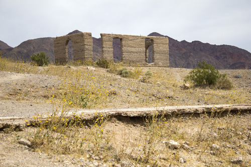
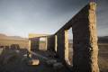
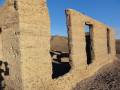
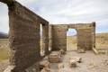
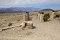
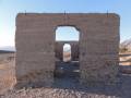
0.0 Ashford Mill Ruins Sign (-87ft.). Wander around the remains of the mill and other buildings. This guide goes down to the office building (the concrete walls), over to the remains of the ore crusher, and finally down to the location of another building before returning to the parking area. (35.918932°, -116.683258°)
0.2 Return to Ashford Mill Ruins Sign (-87ft.). Don’t forget to enjoy the views of the Panamint Mountains (across the valley to the west), Black Mountains (near side of the valley to the east), and into the southerly part of Death Valley. (35.918932°, -116.683258°)
History & More
Ashford Mill was built by the Ashford Brothers in 1914 to process ore from the “Golden Treasure Mine” (Ashford Mine), some 5 miles east of the mill in the Black Mountains. While the mine was never truly profitable, one of the investors helped the brothers build the mill and the concrete office building. One person summed it up that the mine, “was able to produce just enough gold to keep the Ashfords in groceries and lawsuits for more than a third of a century.” The mine was worked intermittently through the 1930s, but it never made any of its owners or leasees rich.
At one time, the mill had a jaw-crusher, a 10ft. Lane mill, a Wilfley table, and a Diester slime table. Today, only the foundations remain.
The colorful slopes of the Black Mountains are especially nice in the afternoon sun, while views to the Panamint Mountains are best in the morning.
Download Route Map
Driving Directions
The road to Ashford Mill is along the Badwater Road. It is on the left, 1.9 miles north of the Badwater Road/Jubilee Pass Road/Harry Wade Road Junction, or on the right 27.2 miles south of the Badwater Basin Parking Area (1.8 miles south of the southern end of the West Side Road.
Leave No Trace Principles are enforced
Drones and model aircrafts are prohibited
Camping is permitted only in designated sites or in areas open to dispersed backcountry camping
Click here for all park rules and regulations
12 Month Pass: $55/Death Valley Annual Pass (valid at Death Valley National Park). $80/America the Beautiful Annual Pass (valid at all national park and federal fee areas). $20/Annual Senior Pass (62 years or older US citizens; valid at all national park and federal fee areas). Free/4th Grade Pass (Valid Sept. 1-August 31 of the child’s 4th Grade school year). Free/Military Pass (valid for all active military personel and their dependents with a CAC Card or DD Form 1173).
Lifetime Pass: $80/Lifetime Senior Pass (62 years or older US citizens; valid at all national park and federal fee areas). Free/Access Pass (available to all US citizens with perminent disabilities). Free/Access for Veterans and Gold Star Families Pass (valid for all military and veterans with a CAC card, Veteran HJealth Identification Card, Veteran ID Card, or veteran’s designation on state-issued drivers license or identification card.)