Shorty’s Well – Death Valley National Park


Photo credit David Whiting, All Rights Reserved

Very short walk to a well discovered by “Shorty” Alexander Zachariah Borden, an early prospector to Death Valley. This is not the same “Shorty” (Frank Harris) who is buried a few miles south along the West Side Road.
| Total Distance: 0.01 miles out & back | Elevation Gain: N/A |
| Difficulty: Moderate | 0-5 Mile Difficulty: Moderate |
| View Rating: 3.0 out of 5.0 stars | Author’s Rating: 2.0 out of 5.0 stars |
| Visitor Rating: (Click to rate) [Total: 0 Average: 0] | Visitor Difficulty Rating: (Click to rate) [Total: 0 Average: 0] |
| Pets: No | Horses: Yes (do not take horses out onto the salt flat) |
| Best Seasons: October-May | Special Permits: None |
| Water Availability: None | Overnight Options: None |
| Trailhead Amenities: None | Crowd Factor: Solitude |
| Trailhead Access: 1.5 | |
| Uses: | Trail Surface: |
| Features: | Hazards: |
Mile-by-Mile: Shorty’s Well
0.0 Shortys Well Parking Area (-253ft.). Follow the vague trail to the well. (36.226611°, -116.880493°)
35ft. Shortys Well (-253ft.). (36.226576°, -116.880368° approximate location)
History & More
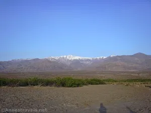
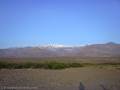
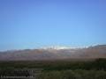
There isn’t much to see at Shortys Well – just a concrete pad and a lot of scrubby bushes. If you want to make your visit more worth-while, try walking east out toward the Badwater Salt Flats. The views toward the Black Mountains in the afternoon or the Panamint Mountains in the morning are quite good.
Shortys Well is named for Alexander Zachariah “Shorty” Borden, who prospected for gold in Death Valley beginning in 1887. While he never struck it rich, he did walk for miles over the entire area, discovering other interesting riches including his well along what is now the West Side Road. He stayed on for many years, becoming known as the “last of the old timers” with a personality full of hospitality and friendliness.
“Shorty” Borden decided to make his fortune by creating a camp in Hanaupah Canyon. Shortly before he opened it to visitors, an enormous flash flood washed the entire camp down onto Badwater Salt Flats. Shorty heard it coming and barely made it to safety on higher ground. Without supplies, he knew he would have to hike to civilization, so he set off at dusk (by this time, he knew quite a bit about the desert, including that you don’t want to hike in the summer heat) – only to find the mouth and alluvial fan of the canyon blocked with mud and debris. It took him most of the night just to wade through the mess. A man named Monroe Wagnon took some trash out to his incinerator in Furnace Creek the next day and spotted Shorty wandering out in the desert – dehydrated and delirious with heat exhaustion. Monroe nursed him back to health, then rescued Shorty again a few days later when the latter tried to hike up to a friend’s cabin/claim in the Panamint Mountains. Shorty took his time recovering after that and lived for many more years, finally dying peacefully at a rest home in San Bernardino.
Download Route Map
Driving Directions
End of Shortys Well Road across from the Hanaupah Canyon Road 10.7 miles from the northern end of the West Side Road and 25.2 miles from the southern end of the West Side Road.
Leave No Trace Principles are enforced
Drones and model aircrafts are prohibited
Camping is permitted only in designated sites or in areas open to dispersed backcountry camping
Click here for all park rules and regulations
12 Month Pass: $55/Death Valley Annual Pass (valid at Death Valley National Park). $80/America the Beautiful Annual Pass (valid at all national park and federal fee areas). $20/Annual Senior Pass (62 years or older US citizens; valid at all national park and federal fee areas). Free/4th Grade Pass (Valid Sept. 1-August 31 of the child’s 4th Grade school year). Free/Military Pass (valid for all active military personel and their dependents with a CAC Card or DD Form 1173).
Lifetime Pass: $80/Lifetime Senior Pass (62 years or older US citizens; valid at all national park and federal fee areas). Free/Access Pass (available to all US citizens with perminent disabilities). Free/Access for Veterans and Gold Star Families Pass (valid for all military and veterans with a CAC card, Veteran HJealth Identification Card, Veteran ID Card, or veteran’s designation on state-issued drivers license or identification card.)