Ubehebe Peak – Death Valley National Park


Take a strenuous, Class 2 trail up to a mountain peak with views across the Racetrack.
| Total Distance: 4.6 miles out & back | Elevation Gain: 2,617ft. (3,708ft. to 5,666ft.) |
| Difficulty: Strenuous | 0-5 Mile Difficulty: Easy |
| View Rating: 5.0 out of 5.0 stars | Author’s Rating: 4.0 out of 5.0 stars |
| Visitor Rating: (Click to rate) [Total: 0 Average: 0] | Visitor Difficulty Rating: (Click to rate) [Total: 0 Average: 0] |
| Pets: No | Horses: No |
| Best Seasons: November-April | Special Permits: None |
| Water Availability: None | Overnight Options: None |
| Trailhead Amenities: None | Crowd Factor: Solitude |
| Trailhead Access: 1.9 | |
| Uses: | Trail Surface: |
| Features: | Hazards: |
Mile-by-Mile: Ubehebe Peak
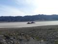
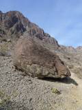
0.0 The Grandstand Parking Area (3,707ft.). Follow the trail for Little Ubehebe Peak up to the Little Ubehebe Peak Saddle. (36.694324°, -117.571711°)
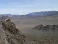
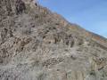
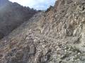
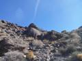
1.8 Little Ubehebe Saddle (5,399ft.). The trail more or less vanishes at this point, though it may be lightly cairned as it travels south along the right (west) side of the ridgeline, descending to a saddle and then rising steeply up Ubehebe Peak. The ridge is narrow and rough with plenty of Class 2 (and at least one Class 3) scrambles. It is sometimes difficult to follow, so if you lose your way, stay fairly close to the ridgeline on the Saline Valley (west) side of the ridge. Don’t try this on a windy day, as the exposure could be dangerous with a lot of wind. (36.696231°, -117.585868°)
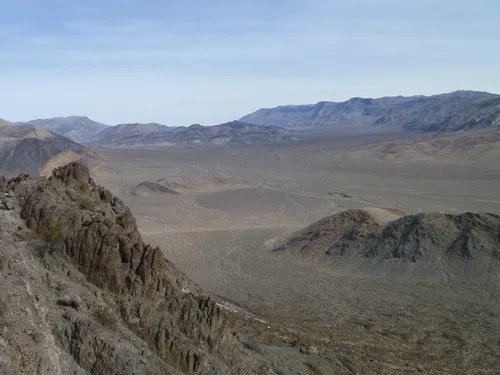
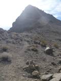
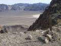
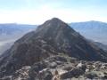
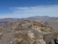
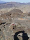
2.3 Ubehebe Peak (5,664ft.). The top of the peak is a little flat, so I recommend walking around to get better views in various directions (especially from the southeast side of the mountain). Enjoy spectacular views over the Last Chance Range (in which Ubehebe Peak resides), Saline Valley and the Inyo Mountains to the west, and the Racetrack and the Cottonwood Mountains to the east. There is a benchmark on the summit. (36.690993°, -117.586048°)
History & More
The scramble from Little Ubehebe Peak to Ubehebe Peak is more difficult than the scramble up to Little Ubehebe Peak. So if you decide it’s more than you want to do, don’t feel like you’ve failed yourself somehow!
It’s hard to say exactly how Ubehebe Peak received its name. Some say that the word means “big basket” in the Paiute language, but no one is quite sure why the peak would be named after a basket.
The area was heavily prospected in the early 1900s. Be wary of possible mine shafts and drill holes, and enjoy the historic junk that was left behind by the miners.
The great views are the reason most people hike Ubehebe Peak. Despite the path being mostly a social trail, it’s fairly well-trodden.
Download Trail Map
Coming Soon!
Driving Directions
Take the Racetrack Road from the Ubehebe Crater Road 25.3 miles from the crater. Turn right into the parking area for the Grandstand. The trail begins from this parking area.
It is extremely dangerous to enter a mine due to unstable shafts, gasses, and more. Do not enter mines, even if they are apparently open!
Walking on, climbing, entering, ascending, descending, or traversing any mine, structure, feature, or ruin is prohibited.
Toxic chemicals or ore may be present around mine sites. Enter at your own risk.
Possessing, destroying, injuring, defacing, removing, digging, or disturbing any mine, structure, feature, or ruin is also prohibited.
Leave No Trace Principles are enforced
Drones and model aircrafts are prohibited
Camping is permitted only in designated sites or in areas open to dispersed backcountry camping
All park rules and regulations
12 Month Pass: $55/Death Valley Annual Pass (valid at Death Valley National Park). $80/America the Beautiful Annual Pass (valid at all national park and federal fee areas). $20/Annual Senior Pass (62 years or older US citizens; valid at all national park and federal fee areas). Free/4th Grade Pass (Valid Sept. 1-August 31 of the child’s 4th Grade school year). Free/Military Pass (valid for all active military personel and their dependents with a CAC Card or DD Form 1173).
Lifetime Pass: $80/Lifetime Senior Pass (62 years or older US citizens; valid at all national park and federal fee areas). Free/Access Pass (available to all US citizens with perminent disabilities). Free/Access for Veterans and Gold Star Families Pass (valid for all military and veterans with a CAC card, Veteran HJealth Identification Card, Veteran ID Card, or veteran’s designation on state-issued drivers license or identification card.)