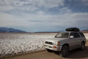
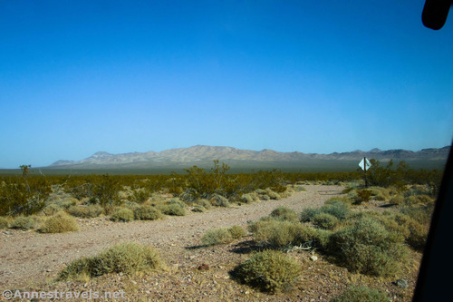
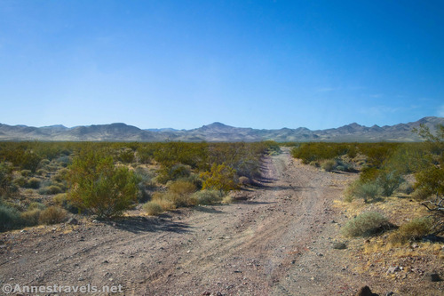
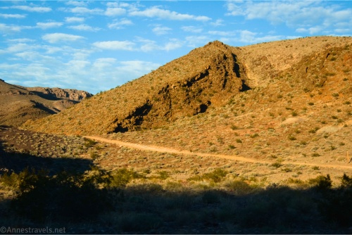
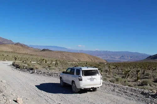
Dirt Road: West Side Road – Death Valley National Park

High clearance-required dirt/gravel road that travels along the west side of Badwater Flats and gives access to 4×4 roads up desert canyons, historic sites, beautiful views, and more. Total Distance: 35.9 miles point-to-point Elevation Gain: 751ft. gain, 736ft. loss N to S Road Difficulty: 1.5 (high clearance required) Bicycle Difficulty: More Difficult View Rating: Author’s […]

4×4 Road: Deadman Pass Road – Death Valley National Park

Drive across Deadman Pass in the Greenwater Mountains between Greenwater Valley Road and CA-127. Total Distance: 13.4 miles point to point Elevation Gain: 341ft. up, 1,278ft. down (3,264ft. to 2,065ft.) Road Difficulty: 2.0 (4×4 required) Bicycle Difficulty: More Difficult View Rating: Author’s Rating: Visitor Rating: Visitor Difficulty Rating: Pets: Leashed Horses: Yes Best Seasons: October-May […]

Gold Valley Road – Death Valley National Park

Follow a 4×4 track off of the Greenwater Valley Road through the Black Mountains to Willow Spring and Gold Valley. Total Distance: 13.0 miles point-to-point (dead end) Elevation Gain: 1,432ft. up, 1,877ft. down (4,479ft. to 2,637ft.) Road Difficulty: 2.0 (4×4 required) Bicycle Difficulty: More Difficult View Rating: Author’s Rating: Visitor Rating: Visitor Difficulty Rating: Pets: […]

Lee’s Camp Road – Death Valley National Park

Rough gravel/dirt road through mining country in the Funeral Mountains and past Lee’s Camp to a point near the “town” of Amargosa Valley. Total Distance: 18.2 miles point-to-point Elevation Gain: 1,658ft. up, 2,849ft. down (2,381ft. to 4,857ft.) Road Difficulty: 2.5+; 2.0 for southern 3 miles; 1.6 for northern 7.6 miles Bicycle Difficulty: Very Difficult View […]

Echo Canyon Road – Death Valley National Park

Gravel/dirt road that gives access to Eye of the Needle Arch and the Inyo Mine. Total Distance: 10.9 miles point to point Elevation Gain: 3,729ft. up, 27.5ft. down (410ft. to 4,120ft.) Road Difficulty: 1.4 for the first 3 miles; 2.0 beyond Bicycle Difficulty: Very Difficult View Rating: Author’s Rating: Visitor Rating: Visitor Difficulty Rating: Pets: […]

Ubehebe Lead Mine – Death Valley National Park

Visit an old lead, copper, gold, and silver mine. Note that the area is hazardous with both toxic chemicals and unstable mine shafts. Total Distance: 0.75 miles point-to-point (dead end) Elevation Gain: 36ft. up, 166ft. down (4,010ft. to 3,860ft.) Road Difficulty: 2.0 Bicycle Difficulty: More Difficult View Rating: Author’s Rating: Visitor Rating: Visitor Difficulty Rating: […]

Racetrack Road – Death Valley National Park

A rough, unpaved, high-clearance-only road that leads to the famous lakebed with mysteriously moving rocks. Do not walk on the playa (mud) if it is wet. Total Distance: 29.5 miles point to point Elevation Gain: 2,693ft. up, 1,419ft. down (2,476ft. to 4,956ft.) Road Difficulty: 1.9 Bicycle Difficulty: More Difficult View Rating: Author’s Rating: Visitor Rating: […]

Latest Trails

2WD Dirt Road Access 4x4 Access 4x4 Dirt Road Backpacking badlands Badwater Road Bicycles Black Mountains CA-190 California canyon colorful rocks Cottonwood Mountains Day Hiking Death Valley National Park Dirt Road Easy Hike Extremely Strenuous Hike Funeral Mountains Geological Interest Ghost Town Grapevine Mountains Harry Wade Road High Clearance Access High Clearance Dirt Road Historic Interest Horses Jeeps Mine Moderate Hike Moderately Strenuous Hike Owlshead Mountains Panamint Mountains Paved Road Access Pets point of interest rock formations Rumored Hike Spring Strenuous Hike Titus Canyon Road Verified Hike Very Strenuous Hike views West Side Road

Categories

Archives